
Articles | Volume 22, issue 4
https://doi.org/10.5194/os-22-2491-2026
© Author(s) 2026. This work is distributed under
the Creative Commons Attribution 4.0 License.
the Creative Commons Attribution 4.0 License.
https://doi.org/10.5194/os-22-2491-2026
© Author(s) 2026. This work is distributed under
the Creative Commons Attribution 4.0 License.
the Creative Commons Attribution 4.0 License.
Technical note
| 
17 Aug 2026
Technical note |
| 17 Aug 2026
| 17 Aug 2026
Evaluate the impact of a 4 h tandem phase on the continuity of nadir altimetry measurements between S3 and S3NG-T
Noémie Lalau
CORRESPONDING AUTHOR

MAGELLIUM, Ramonville Saint-Agne, 31520, France
Michaël Ablain
MAGELLIUM, Ramonville Saint-Agne, 31520, France
Thomas Vaujour
MAGELLIUM, Ramonville Saint-Agne, 31520, France
François Boy
CNES, Toulouse, 31400, France
Gerald Dibarboure
CNES, Toulouse, 31400, France
Alejandro Egido
ESA, ESTEC, Noordwijk, 2201 AZ, The Netherlands
Related authors
Michaël Ablain, Noémie Lalau, Benoit Meyssignac, Robin Fraudeau, Anne Barnoud, Gérald Dibarboure, Alejandro Egido, and Craig Donlon
Ocean Sci., 21, 343–358, https://doi.org/10.5194/os-21-343-2025, https://doi.org/10.5194/os-21-343-2025, 2025
Short summary
Short summary
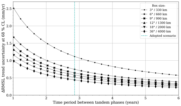
This study proposes a novel cross-validation method to assess the instrumental stability in sea level trends. The method involves implementing a second tandem flight phase between two successive altimeter missions a few years after the first phase. The trend in systematic instrumental differences made during the two tandem phases can be estimated below ± 0.1 mm yr-1 (16–84 % confidence level) on a global scale for time intervals between the tandem phases of 4 years or more.
Andrea Storto, Giulia Chierici, Julia Pfeffer, Anne Barnoud, Romain Bourdalle-Badie, Alejandro Blazquez, Davide Cavaliere, Noémie Lalau, Benjamin Coupry, Marie Drevillon, Sebastien Fourest, Gilles Larnicol, and Chunxue Yang
State Planet, 4-osr8, 12, https://doi.org/10.5194/sp-4-osr8-12-2024, https://doi.org/10.5194/sp-4-osr8-12-2024, 2024
Short summary
Short summary
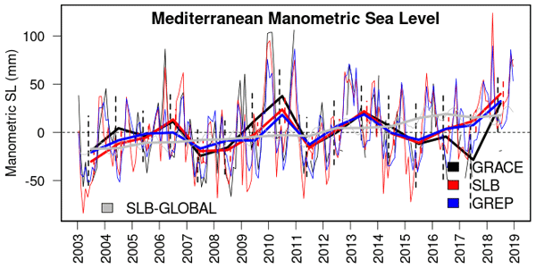
The variability in the manometric sea level (i.e. the sea level mass component) in three ocean basins is investigated in this study using three different methods (reanalyses, gravimetry, and altimetry in combination with in situ observations). We identify the emerging long-term signals, the consistency of the datasets, and the influence of large-scale climate modes on the regional manometric sea level variations at both seasonal and interannual timescales.
Juliette Gamot, Antoine Delepoulle, Francesco Nencioli, Marie-Isabelle Pujol, and Gerald Dibarboure
Earth Syst. Sci. Data, 18, 7043–7070, https://doi.org/10.5194/essd-18-7043-2026, https://doi.org/10.5194/essd-18-7043-2026, 2026
Short summary
Short summary
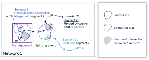
Mesoscale eddies are rotating ocean features that play a key role in transporting heat, salt, and biological material. This study presents a new global dataset derived from satellite observations to track these eddies and identify when they merge or split. By organizing them into interaction networks, we show that such events are frequent and strongly influence eddy evolution, leading to a more realistic description of ocean circulation.
Alejandro Blazquez, Benoit Meyssignac, Robin Fraudeau, Michael Ablain, Jonathan Bamber, Antonio Bonaduce, Marie Bouih, Anny Cazenave, Thorben Döhne, Ines Dussaillant, Ramiro Ferrari, Martin Horwath, Nicolas Kolodziejczyk, Hugo Lecomte, Stephanie Leroux, William Llovel, Daniele Melini, Erwan Oulhen, Thierry Penduff, Roshin P. Raj, Giorgio Spada, Marius Schlaak, Papasarafianou Stamatia, Andrea Storto, Chunxue Yang, and Sarah Connors
Earth Syst. Sci. Data Discuss., https://doi.org/10.5194/essd-2026-627, https://doi.org/10.5194/essd-2026-627, 2026
Preprint under review for ESSD
Short summary
Short summary
Closing the sea‑level budget on annual and longer time scales is a cornerstone of physical oceanography because sea‑level rise is one of the best indicators of climate change, and a closed budget shows we have identified and quantified all major drivers. We examined it from 1993 to 2022, finding an accelerated rise that matched ice melt and warm water until 2015. Afterwards an unexplained gap appears. Better deep‑ocean observations and refined gravity processing are needed to close the budget.
Gwenael Jestin, Sara Fleury, Matthias Raynal, Marta Alves, Fanny Piras, Anaëlle Treboutte, François Boy, Inès Benabdillah, Louise Yu, and Gérald Dibarboure
EGUsphere, https://doi.org/10.5194/egusphere-2026-2569, https://doi.org/10.5194/egusphere-2026-2569, 2026
This preprint is open for discussion and under review for The Cryosphere (TC).
Short summary
Short summary
With its wide swath of 120 km, the SWOT altimeter offers unrivalled spatial and temporal coverage of the polar oceans. But frozen oceans are difficult to study because the ice cover only reveals the open ocean through cracks and polynyas. Whether studying the ice or the ocean, leads and floes must be distinguished. This classification is now available in the CNES L3 product at a resolution of 250 m. This paper outlines the methodology and improvements of the derived ice concentration maps.
Solène Jousset, Sandrine Mulet, Eric Greiner, John Wilkin, Lien Vidar, Léon Chafik, Roshin Raj, Antonio Bonaduce, Nicolas Picot, and Gérald Dibarboure
Earth Syst. Sci. Data, 18, 2285–2303, https://doi.org/10.5194/essd-18-2285-2026, https://doi.org/10.5194/essd-18-2285-2026, 2026
Short summary
Short summary
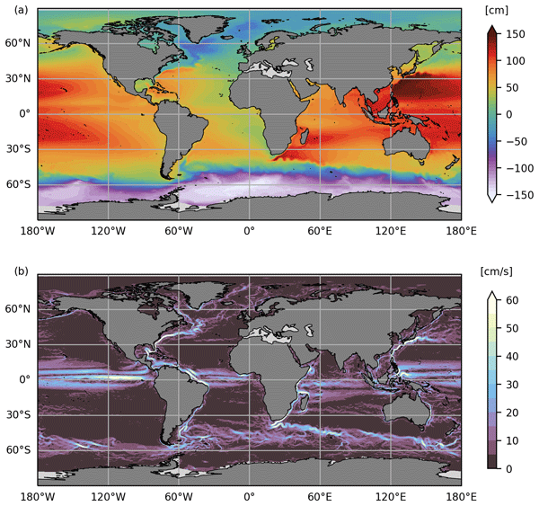
Satellite altimetry has revolutionized ocean observation, making it possible to track sea level with very good spatio-temporal coverage. However, only sea level anomalies are retrieved; to monitor the entire ocean signal, mean dynamic topography (MDT) must be added to these anomalies. In this study, an evaluation of the CNES-CLS22 MDT shows significant improvements in the Arctic. Over the globe, this new solution represents an incremental update to previous CNES-CLS18 MDT.
Louis Kern, Thomas Vaujour, Julia Pfeffer, Andrea Storto, Camille Szczypta, Gilles Garric, Claire Sirere, Gilles Larnicol, Chunxue Yang, Romain Bourdalle-Badie, and Stéphanie Guinehut
EGUsphere, https://doi.org/10.5194/egusphere-2025-6351, https://doi.org/10.5194/egusphere-2025-6351, 2026
Short summary
Short summary
Freshwater fluxes, despite their importance, are often poorly represented in ocean models. The impact of river discharge is evaluated from the Water Mass Balance approach, combining gravimetry and atmospheric reanalyses data. These estimates are assessed against river gauges, highlighting good agreement over South American rivers. Compared to climatological data, when used as inputs for ocean model simulations, this technique improves salinity and upper ocean circulation representation.
Jean H. M. Roger, Yannice Faugère, Hélène Hébert, Antoine Delepoulle, and Gérald Dibarboure
Nat. Hazards Earth Syst. Sci., 26, 943–954, https://doi.org/10.5194/nhess-26-943-2026, https://doi.org/10.5194/nhess-26-943-2026, 2026
Short summary
Short summary
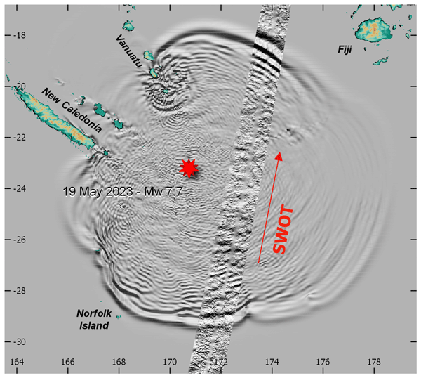
Deployed in 2022, the SWOT (Surface Water Ocean Topography) satellite was flying over the Southwest Pacific on 19 May 2023 when it recorded the tsunami triggered by a magnitude 7.7 earthquake south of the Vanuatu arc. For the very first time, it provided a 2D image of a tsunami wavefield along a straight path. Comparison with numerical tsunami simulations reveals good phase agreement between the modeled wavefield and the SWOT record, but the simulated amplitudes are lower than the measurements.
Cécile Kocha, Marine Liévin, Yann Pageot, Clémence Rubin, Victor Quet, Franck Octau, Marie-Isabelle Pujol, Pierre Prandi, Sabine Philipps, Gerald Dibarboure, Isabelino Denis, Carolina Nogueira Loddo, and François Bignalet-Cazalet
Earth Syst. Sci. Data Discuss., https://doi.org/10.5194/essd-2025-604, https://doi.org/10.5194/essd-2025-604, 2026
Revised manuscript under review for ESSD
Short summary
Short summary
30 years of satellite altimetry data were reprocessed in 2024, using state-of-the-art research algorithms and models. The so-called DT-2024 sea level dataset provides a homogenous and consistent set of observations from 15 satellites and 5 climate reference altimeters. This new dataset is shown to improve mesoscale quality and consistency, particularly over coastal and polar areas, as well as the long-term stability for climate research.
Clément Ubelmann, J. Thomas Farrar, Bertrand Chapron, Lucile Gaultier, Laura Gomez-Navarro, Marie-Hélène Rio, and Gérald Dibarboure
Ocean Sci., 21, 2915–2928, https://doi.org/10.5194/os-21-2915-2025, https://doi.org/10.5194/os-21-2915-2025, 2025
Short summary
Short summary
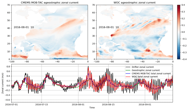
This study models wind-driven ocean currents using observed wind stress and an empirically estimated impulse response function based on drifting buoys. By convolving this function with wind forcing from ERA5, the estimates align well with independent observations across latitudes. Additionally, the response function serves as a valuable indicator of subsurface properties.
Michel Tchilibou, Simon Barbot, Loren Carrere, Ariane Koch-Larrouy, Gérald Dibarboure, and Clément Ubelmann
Ocean Sci., 21, 1469–1486, https://doi.org/10.5194/os-21-1469-2025, https://doi.org/10.5194/os-21-1469-2025, 2025
Short summary
Short summary
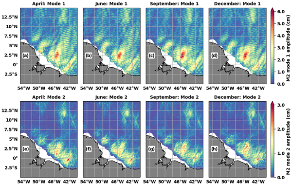
MIOST24 (Multivariate Inversion of Ocean Surface Topography 2024) annual and monthly internal tide (IT) atlases, based on 25 years of altimetry data and an updated wavelength database, are presented for the Indo-Philippine archipelago and the Amazon shelf. The atlases show monthly IT variability and a better correction of IT in altimetry data than with MIOST22 (MIOST 2022) and HRET (High-Resolution Empirical Tide). The results support the development of a global MIOST24.
Pierre-Yves Le Traon, Gérald Dibarboure, Jean-Michel Lellouche, Marie-Isabelle Pujol, Mounir Benkiran, Marie Drevillon, Yann Drillet, Yannice Faugère, and Elisabeth Remy
Ocean Sci., 21, 1329–1347, https://doi.org/10.5194/os-21-1329-2025, https://doi.org/10.5194/os-21-1329-2025, 2025
Short summary
Short summary
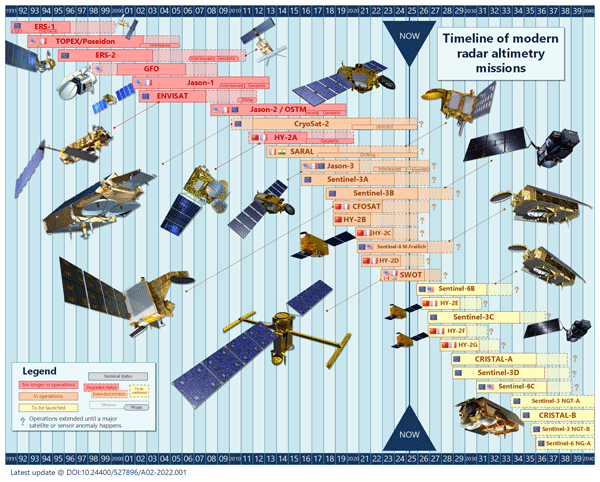
By providing all weather, global, and real-time observations of sea level, a key variable to constrain ocean analysis and forecasting systems, satellite altimetry has had a profound impact on the development of operational oceanography. This paper provides an overview of the development and evolution of satellite altimetry and operational oceanography over the past 20 years from the launch of Jason-1 in 2001 to the launch of SWOT (Surface Water and Ocean Topography) in 2022.
Hélène Etienne, Clément Ubelmann, Fabrice Ardhuin, and Gérald Dibarboure
EGUsphere, https://doi.org/10.5194/egusphere-2025-2890, https://doi.org/10.5194/egusphere-2025-2890, 2025
Preprint archived
Short summary
Short summary
This study analyzes near-inertial oscillations (NIOs) in ocean surface currents using drifter data and the LLC2160 ocean-atmosphere model. It finds that NIOs have a typical spatial decorrelation scale around 100 km, varying with latitude. The model accurately captures these patterns, supporting the ODYSEA concept mission's goal to measure surface currents via Doppler radar and reduce NIO-related data aliasing for better ocean monitoring.

Jérémie Aublanc, François Boy, Franck Borde, and Pierre Féménias
The Cryosphere, 19, 1937–1954, https://doi.org/10.5194/tc-19-1937-2025, https://doi.org/10.5194/tc-19-1937-2025, 2025
Short summary
Short summary
In this study we developed a novel processing chain to derive the ice sheet topography from Sentinel-3 altimetry measurements (named "AMPLI"). The major innovation lies in the use of numerical simulations to geolocate the radar impact point on the ground. The performance improvement is substantial compared to ground segment processing. Furthermore, with AMPLI we show that Sentinel-3 estimates the surface elevation change of the Antarctic ice sheet with a high level of agreement with ICESat-2.
Michaël Ablain, Noémie Lalau, Benoit Meyssignac, Robin Fraudeau, Anne Barnoud, Gérald Dibarboure, Alejandro Egido, and Craig Donlon
Ocean Sci., 21, 343–358, https://doi.org/10.5194/os-21-343-2025, https://doi.org/10.5194/os-21-343-2025, 2025
Short summary
Short summary
This study proposes a novel cross-validation method to assess the instrumental stability in sea level trends. The method involves implementing a second tandem flight phase between two successive altimeter missions a few years after the first phase. The trend in systematic instrumental differences made during the two tandem phases can be estimated below ± 0.1 mm yr-1 (16–84 % confidence level) on a global scale for time intervals between the tandem phases of 4 years or more.
Michel Tchilibou, Loren Carrere, Florent Lyard, Clément Ubelmann, Gérald Dibarboure, Edward D. Zaron, and Brian K. Arbic
Ocean Sci., 21, 325–342, https://doi.org/10.5194/os-21-325-2025, https://doi.org/10.5194/os-21-325-2025, 2025
Short summary
Short summary
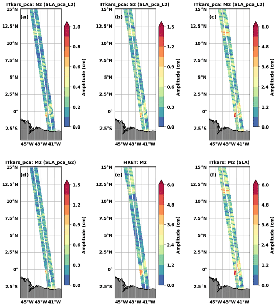
Sea level observations along the swaths of the new SWOT (Surface Water and Ocean Topography) mission were used to characterize internal tides at three semidiurnal frequencies off the Amazon shelf in the tropical Atlantic during the SWOT calibration/validation period. The atlases were derived using harmonic analysis and principal component analysis. The SWOT-derived internal tide atlas outperforms the reference atlas previously used to correct SWOT observations.
Gerald Dibarboure, Cécile Anadon, Frédéric Briol, Emeline Cadier, Robin Chevrier, Antoine Delepoulle, Yannice Faugère, Alice Laloue, Rosemary Morrow, Nicolas Picot, Pierre Prandi, Marie-Isabelle Pujol, Matthias Raynal, Anaelle Tréboutte, and Clément Ubelmann
Ocean Sci., 21, 283–323, https://doi.org/10.5194/os-21-283-2025, https://doi.org/10.5194/os-21-283-2025, 2025
Short summary
Short summary
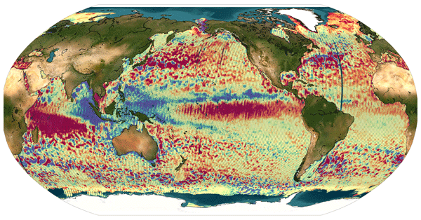
The Surface Water and Ocean Topography (SWOT) mission delivers unprecedented swath-altimetry products. In this paper, we describe how we extended the Level-3 algorithms to handle SWOT’s unique swath-altimeter data. We also illustrate and discuss the benefits, relevance, and limitations of Level-3 swath-altimeter products for various research domains.
Maxime Ballarotta, Clément Ubelmann, Valentin Bellemin-Laponnaz, Florian Le Guillou, Guillaume Meda, Cécile Anadon, Alice Laloue, Antoine Delepoulle, Yannice Faugère, Marie-Isabelle Pujol, Ronan Fablet, and Gérald Dibarboure
Ocean Sci., 21, 63–80, https://doi.org/10.5194/os-21-63-2025, https://doi.org/10.5194/os-21-63-2025, 2025
Short summary
Short summary
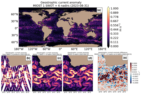
The Surface Water and Ocean Topography (SWOT) mission provides unprecedented swath altimetry data. This study examines SWOT's impact on mapping systems, showing a moderate effect with the current nadir altimetry constellation and a stronger impact with a reduced one. Integrating SWOT with dynamic mapping techniques improves the resolution of satellite-derived products, offering promising solutions for studying and monitoring sea-level variability at finer scales.
Florence Marti, Benoit Meyssignac, Victor Rousseau, Michaël Ablain, Robin Fraudeau, Alejandro Blazquez, and Sébastien Fourest
State Planet, 4-osr8, 3, https://doi.org/10.5194/sp-4-osr8-3-2024, https://doi.org/10.5194/sp-4-osr8-3-2024, 2024
Short summary
Short summary
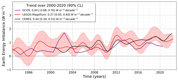
As space geodetic observations are used to monitor the global ocean heat content change, they allow estimating the Earth energy imbalance (EEI). Over 1993–2022, the space geodetic EEI estimate shows a positive trend of 0.29 W m−2 per decade, indicating accelerated warming of the ocean in line with other independent estimates. The study highlights the importance of comparing various estimates and their uncertainties to reliably assess EEI changes.
Andrea Storto, Giulia Chierici, Julia Pfeffer, Anne Barnoud, Romain Bourdalle-Badie, Alejandro Blazquez, Davide Cavaliere, Noémie Lalau, Benjamin Coupry, Marie Drevillon, Sebastien Fourest, Gilles Larnicol, and Chunxue Yang
State Planet, 4-osr8, 12, https://doi.org/10.5194/sp-4-osr8-12-2024, https://doi.org/10.5194/sp-4-osr8-12-2024, 2024
Short summary
Short summary
The variability in the manometric sea level (i.e. the sea level mass component) in three ocean basins is investigated in this study using three different methods (reanalyses, gravimetry, and altimetry in combination with in situ observations). We identify the emerging long-term signals, the consistency of the datasets, and the influence of large-scale climate modes on the regional manometric sea level variations at both seasonal and interannual timescales.
Victor Rousseau, Robin Fraudeau, Matthew Hammond, Odilon Joël Houndegnonto, Michaël Ablain, Alejandro Blazquez, Fransisco Mir Calafat, Damien Desbruyères, Giuseppe Foti, William Llovel, Florence Marti, Benoît Meyssignac, Marco Restano, and Jérôme Benveniste
Earth Syst. Sci. Data Discuss., https://doi.org/10.5194/essd-2023-236, https://doi.org/10.5194/essd-2023-236, 2023
Preprint withdrawn
Short summary
Short summary
The estimation of regional Ocean Heat Content (OHC) is crucial for climate analysis and future climate predictions. In our study, we accurately estimate regional OHC changes in the Atlantic Ocean using satellite and in situ data. Findings reveal significant warming in the Atlantic basin from 2002 to 2020 with a mean trend of 0.17W/m², representing 230 times the power of global nuclear plants. The product has also been successfully validated in the North Atlantic basin using in situ data.

Adrien Guérou, Benoit Meyssignac, Pierre Prandi, Michaël Ablain, Aurélien Ribes, and François Bignalet-Cazalet
Ocean Sci., 19, 431–451, https://doi.org/10.5194/os-19-431-2023, https://doi.org/10.5194/os-19-431-2023, 2023
Short summary
Short summary
Based on the latest satellite observations published by the French space agency CNES, we present the current state of the sea level at the scale of the planet and assess its rise and acceleration over the past 29 years. To support scientific research we provide updated estimations of our confidence in our estimations and highlight key technological and scientific fields. Making progress on that will help to better characterize the sea level in the future.
Karina von Schuckmann, Audrey Minière, Flora Gues, Francisco José Cuesta-Valero, Gottfried Kirchengast, Susheel Adusumilli, Fiammetta Straneo, Michaël Ablain, Richard P. Allan, Paul M. Barker, Hugo Beltrami, Alejandro Blazquez, Tim Boyer, Lijing Cheng, John Church, Damien Desbruyeres, Han Dolman, Catia M. Domingues, Almudena García-García, Donata Giglio, John E. Gilson, Maximilian Gorfer, Leopold Haimberger, Maria Z. Hakuba, Stefan Hendricks, Shigeki Hosoda, Gregory C. Johnson, Rachel Killick, Brian King, Nicolas Kolodziejczyk, Anton Korosov, Gerhard Krinner, Mikael Kuusela, Felix W. Landerer, Moritz Langer, Thomas Lavergne, Isobel Lawrence, Yuehua Li, John Lyman, Florence Marti, Ben Marzeion, Michael Mayer, Andrew H. MacDougall, Trevor McDougall, Didier Paolo Monselesan, Jan Nitzbon, Inès Otosaka, Jian Peng, Sarah Purkey, Dean Roemmich, Kanako Sato, Katsunari Sato, Abhishek Savita, Axel Schweiger, Andrew Shepherd, Sonia I. Seneviratne, Leon Simons, Donald A. Slater, Thomas Slater, Andrea K. Steiner, Toshio Suga, Tanguy Szekely, Wim Thiery, Mary-Louise Timmermans, Inne Vanderkelen, Susan E. Wjiffels, Tonghua Wu, and Michael Zemp
Earth Syst. Sci. Data, 15, 1675–1709, https://doi.org/10.5194/essd-15-1675-2023, https://doi.org/10.5194/essd-15-1675-2023, 2023
Short summary
Short summary
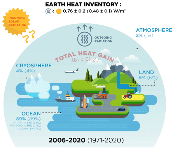
Earth's climate is out of energy balance, and this study quantifies how much heat has consequently accumulated over the past decades (ocean: 89 %, land: 6 %, cryosphere: 4 %, atmosphere: 1 %). Since 1971, this accumulated heat reached record values at an increasing pace. The Earth heat inventory provides a comprehensive view on the status and expectation of global warming, and we call for an implementation of this global climate indicator into the Paris Agreement’s Global Stocktake.

Oscar Vergara, Rosemary Morrow, Marie-Isabelle Pujol, Gérald Dibarboure, and Clément Ubelmann
Ocean Sci., 19, 363–379, https://doi.org/10.5194/os-19-363-2023, https://doi.org/10.5194/os-19-363-2023, 2023
Short summary
Short summary
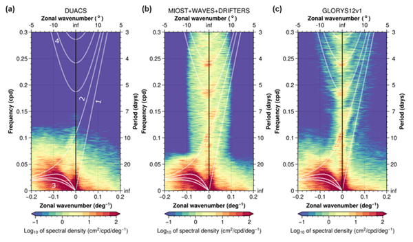
Recent advances allow us to observe the ocean from space with increasingly higher detail, challenging our knowledge of the ocean's surface height signature. We use a statistical approach to determine the spatial scale at which the sea surface height signal is no longer dominated by geostrophic turbulence but in turn becomes dominated by wave-type motions. This information helps us to better use the data provided by ocean-observing satellites and to gain knowledge on climate-driving processes.
Anne Barnoud, Julia Pfeffer, Anny Cazenave, Robin Fraudeau, Victor Rousseau, and Michaël Ablain
Ocean Sci., 19, 321–334, https://doi.org/10.5194/os-19-321-2023, https://doi.org/10.5194/os-19-321-2023, 2023
Short summary
Short summary
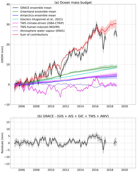
The increase in ocean mass due to land ice melting is responsible for about two-thirds of the global mean sea level rise. The ocean mass variations are monitored by GRACE and GRACE Follow-On gravimetry satellites that faced instrumental issues over the last few years. In this work, we assess the robustness of these data by comparing the ocean mass gravimetry estimates to independent observations (other satellite observations, oceanographic measurements and land ice and water models).
Maxime Ballarotta, Clément Ubelmann, Pierre Veillard, Pierre Prandi, Hélène Etienne, Sandrine Mulet, Yannice Faugère, Gérald Dibarboure, Rosemary Morrow, and Nicolas Picot
Earth Syst. Sci. Data, 15, 295–315, https://doi.org/10.5194/essd-15-295-2023, https://doi.org/10.5194/essd-15-295-2023, 2023
Short summary
Short summary
We present a new gridded sea surface height and current dataset produced by combining observations from nadir altimeters and drifting buoys. This product is based on a multiscale and multivariate mapping approach that offers the possibility to improve the physical content of gridded products by combining the data from various platforms and resolving a broader spectrum of ocean surface dynamic than in the current operational mapping system. A quality assessment of this new product is presented.
Marie-Isabelle Pujol, Stéphanie Dupuy, Oscar Vergara, Antonio Sánchez-Román, Yannice Faugère, Pierre Prandi, Mei-Ling Dabat, Quentin Dagneaux, Marine Lievin, Emeline Cadier, Gérald Dibarboure, and Nicolas Picot
Earth Syst. Sci. Data Discuss., https://doi.org/10.5194/essd-2022-292, https://doi.org/10.5194/essd-2022-292, 2022
Manuscript not accepted for further review
Short summary
Short summary
An altimeter sea level along-track level-3 product with a 5 Hz (~1.2 km) sampling is proposed. It takes advantage of recent advances in radar altimeter processing, and improvements made to different stages of the processing chain. Compared to the conventional 1 Hz (~7 km) product, it significantly improves the observability of the short wavelength signal in open ocean and near coast areas (> 5 km). It also contributes to improving high resolution numerical model outputs via data assimilation.
Rémi Jugier, Michaël Ablain, Robin Fraudeau, Adrien Guerou, and Pierre Féménias
Ocean Sci., 18, 1263–1274, https://doi.org/10.5194/os-18-1263-2022, https://doi.org/10.5194/os-18-1263-2022, 2022
Short summary
Short summary
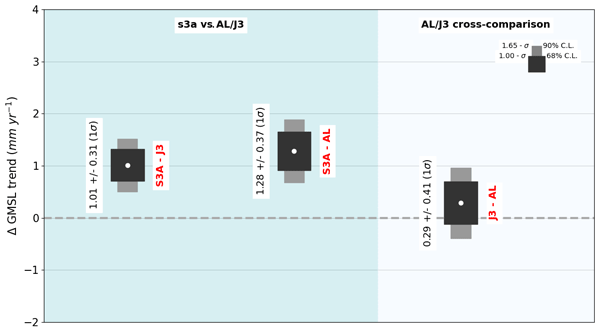
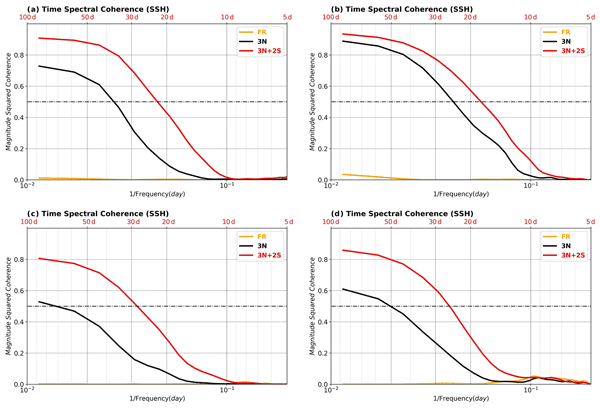
To ensure that the sea level is measured as accurately as possible by satellite altimeters, we must monitor possible sea level drifts caused by those instruments through comparison with other satellite altimeters or tide gauges. In this paper, we describe a method and estimate the associated uncertainties for detecting altimeter drifts over short time periods (from 2 to 10 years) through cross-comparison with other satellite altimeters and apply it to the recent Sentinel-3 A/B altimeters.
Mounir Benkiran, Pierre-Yves Le Traon, and Gérald Dibarboure
Ocean Sci., 18, 609–625, https://doi.org/10.5194/os-18-609-2022, https://doi.org/10.5194/os-18-609-2022, 2022
Short summary
Short summary
The SSH analysis and 7 d forecast error will be globally reduced by almost 50 %. Surface current forecast errors should be equivalent to today’s surface current analysis errors or alternatively will be improved (variance error reduction) by 30 % at the surface and 50 % for 300 m depth.
The resolution capabilities will be drastically improved and will be closer to 100 km wavelength as opposed to today where they are above 250 km (on average).
Clément Ubelmann, Loren Carrere, Chloé Durand, Gérald Dibarboure, Yannice Faugère, Maxime Ballarotta, Frédéric Briol, and Florent Lyard
Ocean Sci., 18, 469–481, https://doi.org/10.5194/os-18-469-2022, https://doi.org/10.5194/os-18-469-2022, 2022
Short summary
Short summary
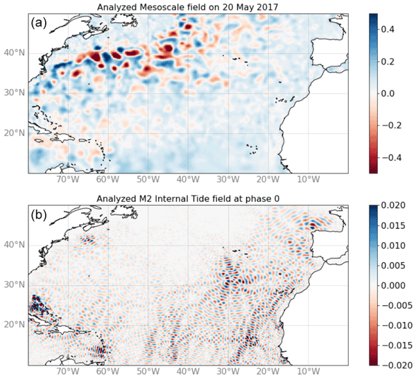
The signature of internal tides has become an important component for high-resolution altimetry over oceans. Several studies have proposed some solutions to resolve part of these internal tides based on the altimetry record. Following these studies, we propose here a new inversion approach aimed to mitigate aliasing with other dynamics. After a description of the methodology, the solution for the main tidal components has been successfully validated against independent observations.

Cori Pegliasco, Antoine Delepoulle, Evan Mason, Rosemary Morrow, Yannice Faugère, and Gérald Dibarboure
Earth Syst. Sci. Data, 14, 1087–1107, https://doi.org/10.5194/essd-14-1087-2022, https://doi.org/10.5194/essd-14-1087-2022, 2022
Short summary
Short summary
The new global Mesoscale Eddy Trajectory Atlases (META3.1exp) provide eddy identification and trajectories from altimetry maps. These atlases comprise an improvement to and continuation of the historical META2.0 product. Changes in the detection parameters and tracking were tested by comparing the eddies from the different datasets. In particular, the eddy contours available in META3.1exp are an asset for multi-disciplinary studies.

Florence Marti, Alejandro Blazquez, Benoit Meyssignac, Michaël Ablain, Anne Barnoud, Robin Fraudeau, Rémi Jugier, Jonathan Chenal, Gilles Larnicol, Julia Pfeffer, Marco Restano, and Jérôme Benveniste
Earth Syst. Sci. Data, 14, 229–249, https://doi.org/10.5194/essd-14-229-2022, https://doi.org/10.5194/essd-14-229-2022, 2022
Short summary
Short summary
The Earth energy imbalance at the top of the atmosphere due to the increase in greenhouse gases and aerosol concentrations is responsible for the accumulation of energy in the climate system. With its high thermal inertia, the ocean accumulates most of this energy excess in the form of heat. The estimation of the global ocean heat content through space geodetic observations allows monitoring of the energy imbalance with realistic uncertainties to better understand the Earth’s warming climate.
Pierre Prandi, Jean-Christophe Poisson, Yannice Faugère, Amandine Guillot, and Gérald Dibarboure
Earth Syst. Sci. Data, 13, 5469–5482, https://doi.org/10.5194/essd-13-5469-2021, https://doi.org/10.5194/essd-13-5469-2021, 2021
Short summary
Short summary
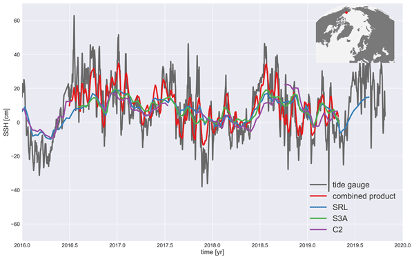
We investigate how mapping sea level in the Arctic Ocean can benefit from combining data from three satellite radar altimeters: CryoSat-2, Sentinel-3A and SARAL/AltiKa. A dedicated processing for SARAL/AltiKa provides a baseline for the cross-referencing of CryoSat-2 and Sentinel-3A before mapping. We show that by combining measurements coming from three missions, we are able to increase the resolution of gridded sea level fields in the ice-covered Arctic Ocean.
Zacharie Barrou Dumont, Simon Gascoin, Olivier Hagolle, Michaël Ablain, Rémi Jugier, Germain Salgues, Florence Marti, Aurore Dupuis, Marie Dumont, and Samuel Morin
The Cryosphere, 15, 4975–4980, https://doi.org/10.5194/tc-15-4975-2021, https://doi.org/10.5194/tc-15-4975-2021, 2021
Short summary
Short summary
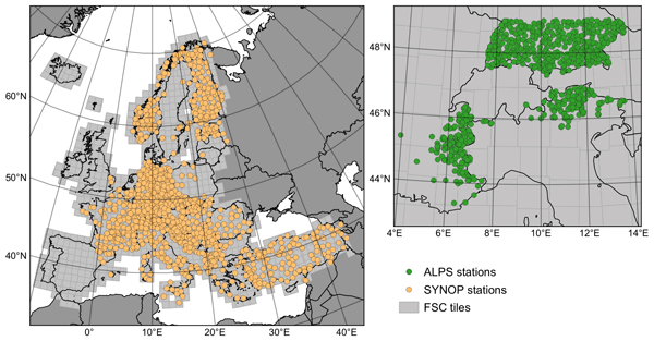
Since 2020, the Copernicus High Resolution Snow & Ice Monitoring Service has distributed snow cover maps at 20 m resolution over Europe in near-real time. These products are derived from the Sentinel-2 Earth observation mission, with a revisit time of 5 d or less (cloud-permitting). Here we show the good accuracy of the snow detection over a wide range of regions in Europe, except in dense forest regions where the snow cover is hidden by the trees.
Cited articles
Ablain, M., Lalau, N., Meyssignac, B., Fraudeau, R., Barnoud, A., Dibarboure, G., Egido, A., and Donlon, C.: Benefits of a second tandem flight phase between two successive satellite altimetry missions for assessing instrumental stability, Ocean Sci., 21, 343–358, https://doi.org/10.5194/os-21-343-2025, 2025. a
Archer, M., Wang, J., Klein, P., Dibarboure, G., and Fu, L.-L.: Wide-swath satellite altimetry unveils global submesoscale ocean dynamics, Nature, 640, 691–696, https://doi.org/10.1038/s41586-025-08722-8, 2025. a
AVISO/DUACS: SWOT Level-3 KaRIn Low Rate SSH Expert, AVISO [data set], https://doi.org/10.24400/527896/A01-2023.018, 2024. a, b
AVISO/DUACS: Along-track Sea Level Anomalies Level-2+ (L2P) NTC 1Hz, AVISO [data set], https://doi.org/10.24400/527896/A01-2025.004, 2025. a
Buijsman, M. C., Waterhouse, A. F., Zaron, E. D., Yadidya, B., Xu, C., Whitley, V., Wenegrat, J. O., Wang, J., Wallcraft, A. J., Varma, D., Tchonang, B. C., Siyanbola, O., Shriver, J. F., Sheremet, V. A., Send, U., Raja, K. J., Polzin, K., Ngodock, H. E., Moulin, A. J., Meiners, G., Lucas, A. J., Lankhorst, M., Kuehl, J. J., Kelly, S. M., Kachelein, L., Huang, Y., Griffin, C., Girton, J. B., Farrar, J. T., Delpech, A., Chen, Z., Chassignet, E. P., Carrier, M. J., Bracco, A., Arbic, B. K., Andres, M., and Abdulfatai, M. A.: A Multiagency Experiment on Internal Wave Energy, Mixing, and Interactions and Their Representation in Global Ocean Models and Operational Forecasts, B. Am. Meteorol. Soc., 107, E158–E182, https://doi.org/10.1175/BAMS-D-24-0174.1, 2026. a
Clerc, S., Donlon, C., Borde, F., Lamquin, N., Hunt, S. E., Smith, D., McMillan, M., Mittaz, J., Woolliams, E., Hammond, M., Banks, C., Moreau, T., Picard, B., Raynal, M., Rieu, P., and Guérou, A.: Benefits and Lessons Learned from the Sentinel-3 Tandem Phase, Remote Sens., 12, 2668, https://doi.org/10.3390/rs12172668, 2020. a, b
Cronin, M., Weller, R., Lampitt, R., and Send, U.: Ocean Reference Stations, in: Earth Observation, edited by: Rustamov, R., InTech, ISBN 978-953-307-973-8, https://doi.org/10.5772/27423, 2012. a
Dibarboure, G., Pujol, M.-I., Briol, F., Traon, P. Y. L., Larnicol, G., Picot, N., Mertz, F., and Ablain, M.: Jason-2 in DUACS: Updated System Description, First Tandem Results and Impact on Processing and Products, Mar. Geod., 34, 214–241, https://doi.org/10.1080/01490419.2011.584826, 2011. a
Dinardo, S., Maraldi, C., Daguze, J.-A., Amraoui, S., Boy, F., Moreau, T., and Picot, N.: Sentinel-6 MF Poseidon-4 Radar Altimeter In-Flight Calibration and Performances Monitoring, AVISO, https://doi.org/10.24400/527896/A03-2022.3377, 2022. a
Dorandeu, J., Ablain, M., Faugère, Y., Mertz, F., Soussi, B., and Vincent, P.: Jason-1 global statistical evaluation and performance assessment: Calibration and cross-calibration results, Mar. Geod., 27, 345–372, https://doi.org/10.1080/01490410490889094, 2004. a
Dufau, C., Orsztynowicz, M., Dibarboure, G., Morrow, R., and Le Traon, P.: Mesoscale resolution capability of altimetry: Present and future, J. Geophys. Res.-Oceans, 121, 4910–4927, https://doi.org/10.1002/2015JC010904, 2016. a
European Space Agency: Copernicus Sentinel-3 Next Generation Topography Mission Requirements Document, Tech. rep., European Space Agency, https://doi.org/10.5281/ZENODO.17454428, version number: 1.0, 2025. a
Guérou, A., Meyssignac, B., Prandi, P., Ablain, M., Ribes, A., and Bignalet-Cazalet, F.: Current observed global mean sea level rise and acceleration estimated from satellite altimetry and the associated measurement uncertainty, Ocean Sci., 19, 431–451, https://doi.org/10.5194/os-19-431-2023, 2023. a, b, c
Henry, O., Ablain, M., Meyssignac, B., Cazenave, A., Masters, D., Nerem, S., and Garric, G.: Effect of the processing methodology on satellite altimetry-based global mean sea level rise over the Jason-1 operating period, J. Geodesy, 88, 351–361, https://doi.org/10.1007/s00190-013-0687-3, 2014. a
Leuliette, E., Nerem, R. S., and Mitchum, G. T.: Calibration of TOPEX/Poseidon and Jason Altimeter Data to Construct a Continuous Record of Mean Sea Level Change, Mar. Geod., 27, 79–94, https://doi.org/10.1080/01490410490465193, 2004. a
Masters, D., Nerem, R. S., Choe, C., Leuliette, E., Beckley, B., White, N., and Ablain, M.: Comparison of Global Mean Sea Level Time Series from TOPEX/Poseidon, Jason-1, and Jason-2, Mar. Geod., 35, 20–41, https://doi.org/10.1080/01490419.2012.717862, 2012. a
Morrow, R., Fu, L.-L., Ardhuin, F., Benkiran, M., Chapron, B., Cosme, E., d’Ovidio, F., Farrar, J. T., Gille, S. T., Lapeyre, G., Le Traon, P.-Y., Pascual, A., Ponte, A., Qiu, B., Rascle, N., Ubelmann, C., Wang, J., and Zaron, E. D.: Global Observations of Fine-Scale Ocean Surface Topography With the Surface Water and Ocean Topography (SWOT) Mission, Front. Mar. Sci., 6, 232, https://doi.org/10.3389/fmars.2019.00232, 2019. a
Nilsson, J., Desai, S., Desjonqueres, J.-D., and Haines, B.: Global cross-calibration of the Jason-3 and Sentinel-6 Michael Freilich missions during their tandem period, AVISO, https://doi.org/10.24400/527896/A03-2022.3354, 2022. a
Prandi, P., Meyssignac, B., Ablain, M., Spada, G., Ribes, A., and Benveniste, J.: Local sea level trends, accelerations and uncertainties over 1993–2019, Sci. Data, 8, 1, https://doi.org/10.1038/s41597-020-00786-7, 2021. a, b
Rieu, P., Moreau, T., Cadier, E., Raynal, M., Clerc, S., Donlon, C., Borde, F., Boy, F., and Maraldi, C.: Exploiting the Sentinel-3 tandem phase dataset and azimuth oversampling to better characterize the sensitivity of SAR altimeter sea surface height to long ocean waves, Adv. Space Res., 67, 253–265, https://doi.org/10.1016/j.asr.2020.09.037, 2021. a
AVISO+: Along-track Level-2+ (L2P) Sea Level Anomaly Sentinel-3 / Jason-CS-Sentinel-6 Product Handbook, https://www.aviso.altimetry.fr/fileadmin/documents/data/tools/hdbk_L2P_S3_S6.pdf (last access: 29 July 2026), 2022. a
Zawadzki, L. and Ablain, M.: Accuracy of the mean sea level continuous record with future altimetric missions: Jason-3 vs. Sentinel-3a, Ocean Sci., 12, 9–18, https://doi.org/10.5194/os-12-9-2016, 2016. a, b
Zhao, Z.: Internal Tides From SWOT: A 75‐Day Instantaneous Mode‐1 M2 Internal Tide Model, J. Geophys. Res.-Oceans, 129, e2024JC021174, https://doi.org/10.1029/2024JC021174, 2024. a
Short summary
We investigated how to maintain continuous sea level measurements between current Sentinel-3 constellation and the upcoming Sentinel-3 Next Generation Topography mission. Because of new satellite designs, a 4-hour delay will exists between observations during the calibration phase. By simulating this time lag, we found that, despite increased uncertainty, reliable calibration is possible. Extending this phase to one year ensures a stable, long-term record for climate and ocean monitoring.
We investigated how to maintain continuous sea level measurements between current Sentinel-3...


