Articles | Volume 22, issue 3
https://doi.org/10.5194/os-22-1681-2026
© Author(s) 2026. This work is distributed under
the Creative Commons Attribution 4.0 License.

https://doi.org/10.5194/os-22-1681-2026
© Author(s) 2026. This work is distributed under
the Creative Commons Attribution 4.0 License.
Tide of the Time: Global tidal characteristics observed from in-situ measurements
Michael G. Hart-Davis

CORRESPONDING AUTHOR
Deutsches Geodätisches Forschungsinstitut, Technische Universität München, Germany
Roman Sulzbach
GFZ Helmholtz Centre for Geosciences, Telegrafenberg, Potsdam, Germany
Stefan A. Talke
Department of Civil and Environmental Engineering, California Polytechnic State University, California, USA
Ivan D. Haigh
Dept. of Civil, Environmental and Construction Engineering, University of Central Florida, Florida, USA
Center for Integrated Coastal Research, University of Central Florida, Florida, USA
Marta Marcos
IMEDEA (UIB-CSIC), Esporles, Balearic Islands, Spain
Philip Woodworth
National Oceanography Centre, Liverpool, UK
Richard Ray
NASA Goddard Space Flight Center, Greenbelt, MD, USA
Ole B. Andersen
DTU Space, Technical University of Denmark, Kongens Lyngby, Denmark
Florent Lyard
LEGOS, Université de Toulouse, CNES, CNRS, IRD, Toulouse, France
Ergane Fouchet
Mercator Ocean International, Toulouse, France
Denise Dettmering
Deutsches Geodätisches Forschungsinstitut, Technische Universität München, Germany
Maik Thomas
GFZ Helmholtz Centre for Geosciences, Telegrafenberg, Potsdam, Germany
Institute for Meteorology, Freie Universität Berlin, Berlin, Germany
Florian Seitz
Deutsches Geodätisches Forschungsinstitut, Technische Universität München, Germany
Related authors
Issufo Halo, Tarron Lamont, Michael Hart-Davis, Pierrick Penven, Isabelle Ansorge, Chris Reason, Bjorn Backeberg, Siren Rühs, Erik van Sebille, Christo Whittle, Annette Samuelsen, Johnny Johannessen, Tamaryn Morris, Marjolaine Krug, Juliet Hermes, Marek Ostrowski, Sheveenah Taukoor, and Babatunde Abiodun
EGUsphere, https://doi.org/10.5194/egusphere-2025-6573, https://doi.org/10.5194/egusphere-2025-6573, 2026
Short summary
Short summary
This review synthesizes two decades of research on the Greater Agulhas Current System, a major ocean current influencing climate, weather and marine life around southern Africa and beyond. Using improved observations, satellites, and computer models, we show how this system transports properties between oceans, affects rainfall and climate patterns, and marine ecosystems. The findings highlight its global climate importance and the need for sustained monitoring to better predict future change.
Michael G. Hart-Davis, Gaia Piccioni, Denise Dettmering, Christian Schwatke, Marcello Passaro, and Florian Seitz
Earth Syst. Sci. Data, 13, 3869–3884, https://doi.org/10.5194/essd-13-3869-2021, https://doi.org/10.5194/essd-13-3869-2021, 2021
Short summary
Short summary
Ocean tides are an extremely important process for a variety of oceanographic applications, particularly in understanding coastal sea-level rise. Tidal signals influence satellite altimetry estimations of the sea surface, which has resulted in the development of ocean tide models to account for such signals. The EOT20 ocean tide model has been developed at DGFI-TUM using residual analysis of satellite altimetry, with the focus on improving the estimation of ocean tides in the coastal region.
Mathilde Cancet, Florence Birol, Oscar Vergara, Quentin Dagneaux, Fabien Léger, François Bignalet-Cazalet, Jean-Alexis Daguze, Ergane Fouchet, Alexandre Homerin, Claire Maraldi, Fernando Niño, Marie-Isabelle Pujol, and Ngan Tran
Earth Syst. Sci. Data, 18, 2319–2347, https://doi.org/10.5194/essd-18-2319-2026, https://doi.org/10.5194/essd-18-2319-2026, 2026
Short summary
Short summary
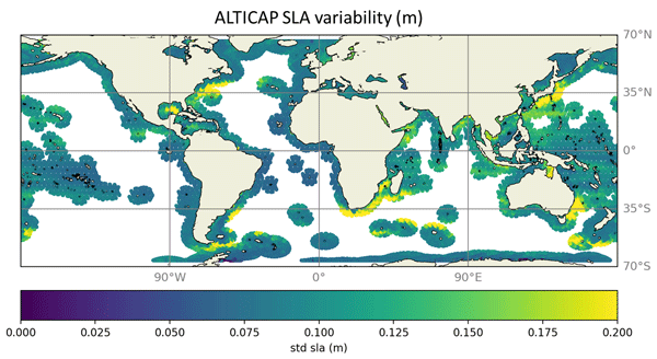
Observing sea level variations at high resolution is paramount for coastal scientific, societal and economic issues. ALTICAP (ALTimetry Innovative Coastal Approach Product) is a new product of Sea Level Anomaly derived from Jason-3 20 Hz along track satellite altimetry and benefiting from the most recent corrections. It covers all coastal ocean up to 500 km from land, from February 2016 to July 2021. It also provides collocated altimetric significant wave height and wind speed.
Issufo Halo, Tarron Lamont, Michael Hart-Davis, Pierrick Penven, Isabelle Ansorge, Chris Reason, Bjorn Backeberg, Siren Rühs, Erik van Sebille, Christo Whittle, Annette Samuelsen, Johnny Johannessen, Tamaryn Morris, Marjolaine Krug, Juliet Hermes, Marek Ostrowski, Sheveenah Taukoor, and Babatunde Abiodun
EGUsphere, https://doi.org/10.5194/egusphere-2025-6573, https://doi.org/10.5194/egusphere-2025-6573, 2026
Short summary
Short summary
This review synthesizes two decades of research on the Greater Agulhas Current System, a major ocean current influencing climate, weather and marine life around southern Africa and beyond. Using improved observations, satellites, and computer models, we show how this system transports properties between oceans, affects rainfall and climate patterns, and marine ecosystems. The findings highlight its global climate importance and the need for sustained monitoring to better predict future change.
Fernand Assene, Ariane Koch-Larrouy, Carina Regina de Macedo, Isabelle Dadou, Michel Tchilibou, Guillaume Morvan, Damien Allain, Simon Barbot, Alex Costa da Silva, Jérôme Chanut, Vincent Vantrepotte, Florent Lyard, Edward Zaron, and Trung-Kien Tran
EGUsphere, https://doi.org/10.5194/egusphere-2026-557, https://doi.org/10.5194/egusphere-2026-557, 2026
Short summary
Short summary
We examine temperature (T) variability at two semidiurnal and one fortnightly frequencies in North Brazil using satellite-observed and modeled temperatures. Semidiurnal T variability is weak offshore but peaks over the shelf due to barotropic mixing. Below 100 m, internal tide (IT)-driven mixing causes strong T variability (0.6–2 °C). T fortnightly maximums (~0.15 °C) appear along IT pathways, showing their key role.
Felix L. Müller, Denise Dettmering, and Florian Seitz
The Cryosphere, 20, 397–409, https://doi.org/10.5194/tc-20-397-2026, https://doi.org/10.5194/tc-20-397-2026, 2026
Short summary
Short summary
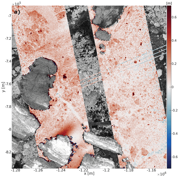
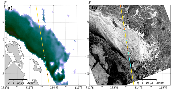
This study evaluates Arctic-wide sea surface height observations by the Surface Water and Ocean Topography (SWOT) mission by comparing them with laser altimetry and radar imagery. Using data from over 550 crossovers, the analysis shows good agreement, with mean absolute water differences of around 5 cm, but also larger discrepancies during winter and early melt. These results illustrate both the potential but also arising problem areas of swath altimetry in the polar regions.
Philip L. Woodworth and Thorkild Aarup
Hist. Geo Space. Sci., 17, 1–12, https://doi.org/10.5194/hgss-17-1-2026, https://doi.org/10.5194/hgss-17-1-2026, 2026
Short summary
Short summary
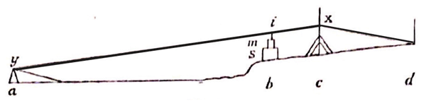
Three historic tide gauge records from Svalbard were converted from 19th century tabulations into computer files. They are good quality and can be used in modern tidal analysis. We confirmed previous findings on tidal constants and showed how little non-tidal variability in sea level there was at these times. One gauge used had an unusual design but it worked well and so deserves to be known. Biographical information is given on the people who acquired these data.
Arne Bendinger, Sophie Cravatte, Lionel Gourdeau, Clément Vic, and Florent Lyard
Ocean Sci., 21, 1943–1966, https://doi.org/10.5194/os-21-1943-2025, https://doi.org/10.5194/os-21-1943-2025, 2025
Short summary
Short summary
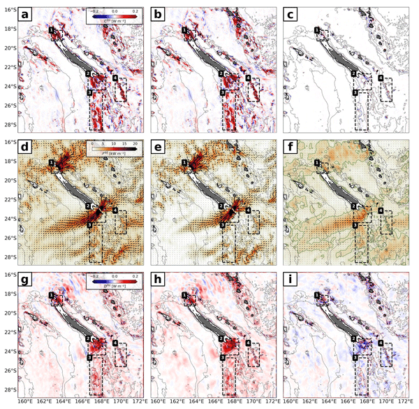
Temporal variability of the semidiurnal internal tide around New Caledonia is investigated using regional modeling. An important contribution to temporal variability not linked to the spring–neap tide cycle is due to the presence of mesoscale eddies both at the generation sites and in the propagation direction. The incoherent tide has a widespread signature in sea surface height (SSH), challenging the SSH observability of mesoscale to submesoscale dynamics.
Bjarke Nilsson, Ole Baltazar Andersen, and Per Knudsen
Earth Syst. Sci. Data Discuss., https://doi.org/10.5194/essd-2025-404, https://doi.org/10.5194/essd-2025-404, 2025
Preprint under review for ESSD
Short summary
Short summary
The average height of the sea surface is important to understand if we are to accurately understand either the dynamic ocean or improve our understanding of the shape of the earth’s surface. Currently we have been able to understand this to a certain degree, but with data from the new Surface Water and Ocean Topography (SWOT) satellite, we are now able to map the sea surface at a very small scale. We utilize this new data to better understand and map the shape of the global oceans.
Yihao Wu, Hongkai Shi, Dongzhen Jia, Ole Baltazar Andersen, Xiufeng He, Zhicai Luo, Yu Li, Shiyuan Chen, Xiaohuan Si, Sisu Diao, Yihuang Shi, and Yanglin Chen
Earth Syst. Sci. Data, 17, 2463–2488, https://doi.org/10.5194/essd-17-2463-2025, https://doi.org/10.5194/essd-17-2463-2025, 2025
Short summary
Short summary
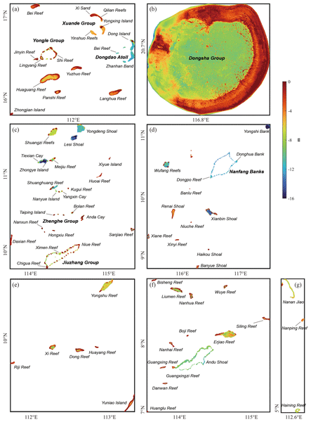
We developed a high-quality and cost-effective shallow-water depth model for >120 islands in the South China Sea, using ICESat-2 and Sentinel-2 satellite data. This model maps water depths with an accuracy of ~1 m. Our findings highlight the limitations of existing global bathymetry models in shallow regions. Our model exhibited superior performance in capturing fine-scale bathymetric features with unprecedented spatial resolution, providing essential data for marine applications.
Michel Tchilibou, Loren Carrere, Florent Lyard, Clément Ubelmann, Gérald Dibarboure, Edward D. Zaron, and Brian K. Arbic
Ocean Sci., 21, 325–342, https://doi.org/10.5194/os-21-325-2025, https://doi.org/10.5194/os-21-325-2025, 2025
Short summary
Short summary
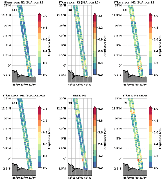
Sea level observations along the swaths of the new SWOT (Surface Water and Ocean Topography) mission were used to characterize internal tides at three semidiurnal frequencies off the Amazon shelf in the tropical Atlantic during the SWOT calibration/validation period. The atlases were derived using harmonic analysis and principal component analysis. The SWOT-derived internal tide atlas outperforms the reference atlas previously used to correct SWOT observations.
Angélique Melet, Roderik van de Wal, Angel Amores, Arne Arns, Alisée A. Chaigneau, Irina Dinu, Ivan D. Haigh, Tim H. J. Hermans, Piero Lionello, Marta Marcos, H. E. Markus Meier, Benoit Meyssignac, Matthew D. Palmer, Ronja Reese, Matthew J. R. Simpson, and Aimée B. A. Slangen
State Planet, 3-slre1, 4, https://doi.org/10.5194/sp-3-slre1-4-2024, https://doi.org/10.5194/sp-3-slre1-4-2024, 2024
Short summary
Short summary
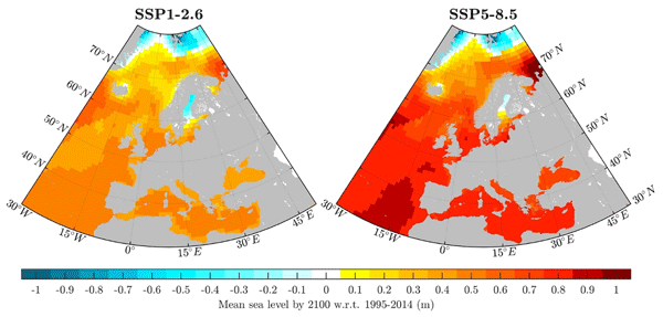
The EU Knowledge Hub on Sea Level Rise’s Assessment Report strives to synthesize the current scientific knowledge on sea level rise and its impacts across local, national, and EU scales to support evidence-based policy and decision-making, primarily targeting coastal areas. This paper complements IPCC reports by documenting the state of knowledge of observed and 21st century projected changes in mean and extreme sea levels with more regional information for EU seas as scoped with stakeholders.
Philip L. Woodworth
Ocean Sci., 20, 887–894, https://doi.org/10.5194/os-20-887-2024, https://doi.org/10.5194/os-20-887-2024, 2024
Short summary
Short summary
This paper makes use of historic tide gauge measurements at Port Louis in the Falkland Islands made by James Clark Ross in 1842 to see whether there have been long-term changes in the ocean tide at that location. The conclusion is that there is no evidence for any significant change, which contrasts with tide gauge findings from other parts of the world over similar timescales.
Nil Carrion-Bertran, Albert Falqués, Francesca Ribas, Daniel Calvete, Rinse de Swart, Ruth Durán, Candela Marco-Peretó, Marta Marcos, Angel Amores, Tim Toomey, Àngels Fernández-Mora, and Jorge Guillén
Earth Surf. Dynam., 12, 819–839, https://doi.org/10.5194/esurf-12-819-2024, https://doi.org/10.5194/esurf-12-819-2024, 2024
Short summary
Short summary
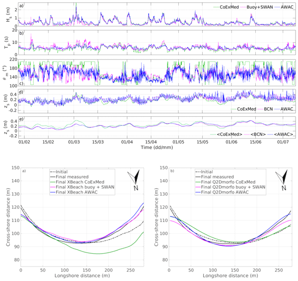
The sensitivity to the wave and sea-level forcing sources in predicting a 6-month embayed beach evolution is assessed using two different morphodynamic models. After a successful model calibration using in situ data, other sources are applied. The wave source choice is critical: hindcast data provide wrong results due to an angle bias, whilst the correct dynamics are recovered with the wave conditions from an offshore buoy. The use of different sea-level sources gives no significant differences.
Ole Baltazar Andersen, Stine Kildegaard Rose, Adili Abulaitijiang, Shengjun Zhang, and Sara Fleury
Earth Syst. Sci. Data, 15, 4065–4075, https://doi.org/10.5194/essd-15-4065-2023, https://doi.org/10.5194/essd-15-4065-2023, 2023
Short summary
Short summary
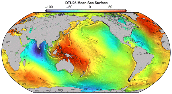
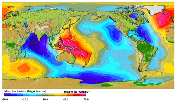
The mean sea surface (MSS) is an important reference for mapping sea-level changes across the global oceans. It is widely used by space agencies in the definition of sea-level anomalies as mapped by satellite altimetry from space. Here a new fully global high-resolution mean sea surface called DTU21MSS is presented, and a suite of evaluations are performed to demonstrate its performance.
Arne Bendinger, Sophie Cravatte, Lionel Gourdeau, Laurent Brodeau, Aurélie Albert, Michel Tchilibou, Florent Lyard, and Clément Vic
Ocean Sci., 19, 1315–1338, https://doi.org/10.5194/os-19-1315-2023, https://doi.org/10.5194/os-19-1315-2023, 2023
Short summary
Short summary
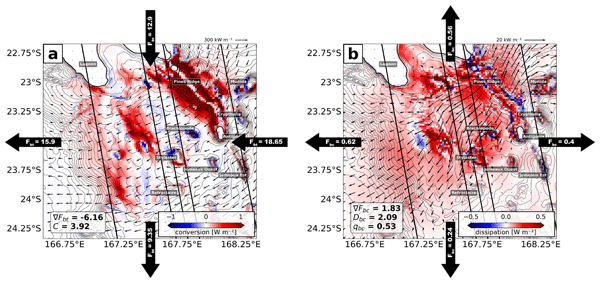
New Caledonia is a hot spot of internal-tide generation due to complex bathymetry. Regional modeling quantifies the coherent internal tide and shows that most energy is converted in shallow waters and on very steep slopes. The region is a challenge for observability of balanced dynamics due to strong internal-tide sea surface height (SSH) signatures at similar wavelengths. Correcting the SSH for the coherent internal tide may increase the observability of balanced motion to < 100 km.
Stefan A. Talke, David A. Jay, and Heida L. Diefenderfer
Hydrol. Earth Syst. Sci., 27, 2807–2826, https://doi.org/10.5194/hess-27-2807-2023, https://doi.org/10.5194/hess-27-2807-2023, 2023
Short summary
Short summary
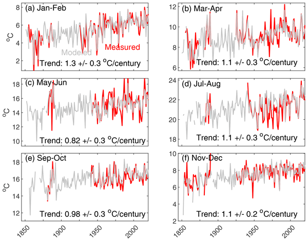
Archival measurements and a statistical model show that average water temperature in a major US West Coast river has increased by 1.8 °C since 1850, at a rate of 1.1 °C per century. The largest factor driving modeled changes are warming air temperatures (nearly 75 %). The remainder is primarily caused by depth increases and other modifications to the river system. Near-freezing conditions, common historically, no longer occur, and the number of warm water days has significantly increased.
Adam T. Devlin, David A. Jay, Stefan A. Talke, and Jiayi Pan
Ocean Sci., 19, 517–534, https://doi.org/10.5194/os-19-517-2023, https://doi.org/10.5194/os-19-517-2023, 2023
Short summary
Short summary
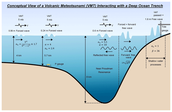
Volcanic meteotsunamis (VMTs) are global with impacts dependent on local topography. The impacts of a volcanic meteotsunami may occur where the oceanic tsunami is not present. Tsunami warning systems do not consider VMTs which can arrive first and may be several meters for a large volcanic eruption at locations with ideal topographical or bathymetric conditions. Here, we analyzed this event using high-frequency tide gauge data along with deep-water buoys and air pressure gauges worldwide.
Víctor Malagón-Santos, Aimée B. A. Slangen, Tim H. J. Hermans, Sönke Dangendorf, Marta Marcos, and Nicola Maher
Ocean Sci., 19, 499–515, https://doi.org/10.5194/os-19-499-2023, https://doi.org/10.5194/os-19-499-2023, 2023
Short summary
Short summary
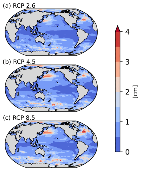
Climate change will alter heat and freshwater fluxes as well as ocean circulation, driving local changes in sea level. This sea-level change component is known as ocean dynamic sea level (DSL), and it is usually projected using computationally expensive global climate models. Statistical models are a cheaper alternative for projecting DSL but may contain significant errors. Here, we partly remove those errors (driven by internal climate variability) by using pattern recognition techniques.
Felix L. Müller, Stephan Paul, Stefan Hendricks, and Denise Dettmering
The Cryosphere, 17, 809–825, https://doi.org/10.5194/tc-17-809-2023, https://doi.org/10.5194/tc-17-809-2023, 2023
Short summary
Short summary
Thinning sea ice has significant impacts on the energy exchange between the atmosphere and the ocean. In this study we present visual and quantitative comparisons of thin-ice detections obtained from classified Cryosat-2 radar reflections and thin-ice-thickness estimates derived from MODIS thermal-infrared imagery. In addition to good comparability, the results of the study indicate the potential for a deeper understanding of sea ice in the polar seas and improved processing of altimeter data.
Ariadna Martín, Angel Amores, Alejandro Orfila, Tim Toomey, and Marta Marcos
Nat. Hazards Earth Syst. Sci., 23, 587–600, https://doi.org/10.5194/nhess-23-587-2023, https://doi.org/10.5194/nhess-23-587-2023, 2023
Short summary
Short summary
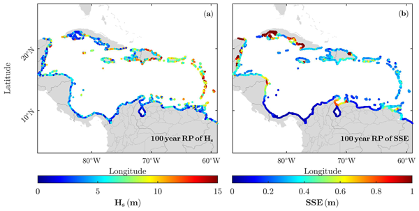
Tropical cyclones (TCs) are among the potentially most hazardous phenomena affecting the coasts of the Caribbean Sea. This work simulates the coastal hazards in terms of sea surface elevation and waves that originate through the passage of these events. A set of 1000 TCs have been simulated, obtained from a set of synthetic cyclones that are consistent with present-day climate. Given the large number of hurricanes used, robust values of extreme sea levels and waves are computed along the coasts.
Carolina M. L. Camargo, Riccardo E. M. Riva, Tim H. J. Hermans, Eike M. Schütt, Marta Marcos, Ismael Hernandez-Carrasco, and Aimée B. A. Slangen
Ocean Sci., 19, 17–41, https://doi.org/10.5194/os-19-17-2023, https://doi.org/10.5194/os-19-17-2023, 2023
Short summary
Short summary
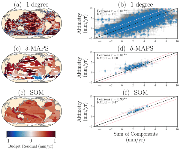
Sea-level change is mainly caused by variations in the ocean’s temperature and salinity and land ice melting. Here, we quantify the contribution of the different drivers to the regional sea-level change. We apply machine learning techniques to identify regions that have similar sea-level variability. These regions reduce the observational uncertainty that has limited the regional sea-level budget so far and highlight how large-scale ocean circulation controls regional sea-level change.
Philip L. Woodworth and John M. Vassie
Earth Syst. Sci. Data, 14, 4387–4396, https://doi.org/10.5194/essd-14-4387-2022, https://doi.org/10.5194/essd-14-4387-2022, 2022
Short summary
Short summary
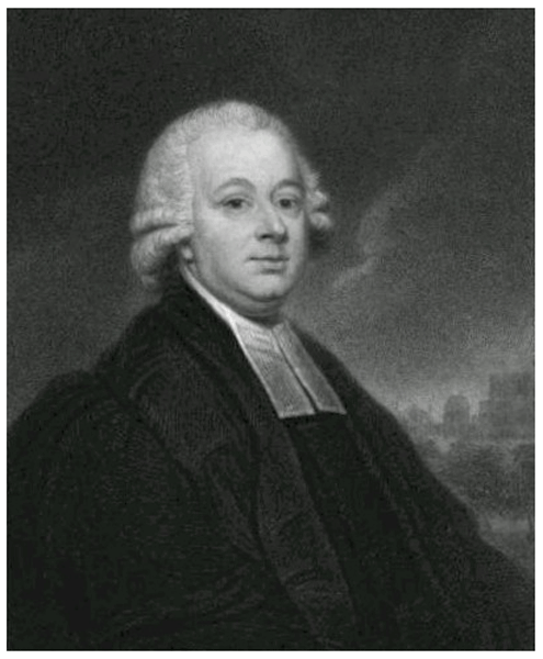
An electronic data set of tidal measurements at St. Helena in 1761 by Nevil Maskelyne is described. These data were first analysed by Cartwright in papers on changing tides, but his data files were never archived. The now newly digitised Maskelyne data have been reanalysed in order to obtain an updated impression of whether the tide has changed at that location in over two and a half centuries. Our main conclusion is that the major tidal constituent (M2) has changed little.
Ramin Familkhalili, Stefan A. Talke, and David A. Jay
Ocean Sci., 18, 1203–1220, https://doi.org/10.5194/os-18-1203-2022, https://doi.org/10.5194/os-18-1203-2022, 2022
Short summary
Short summary
Storm surges, tides, and high river flows often combine to cause flooding in estuaries, a problem known as compound flooding. In this study, we investigate these factors and how changes to estuary and river geometry influence peak water levels. This study offers an analytical framework for reducing estuary flood risk via a better understanding of how bathymetry, surge timescale, and river discharge affect surge and tidal amplitudes and flood heights and inundation in these systems.
Richard D. Ray
Ocean Sci., 18, 1073–1079, https://doi.org/10.5194/os-18-1073-2022, https://doi.org/10.5194/os-18-1073-2022, 2022
Short summary
Short summary
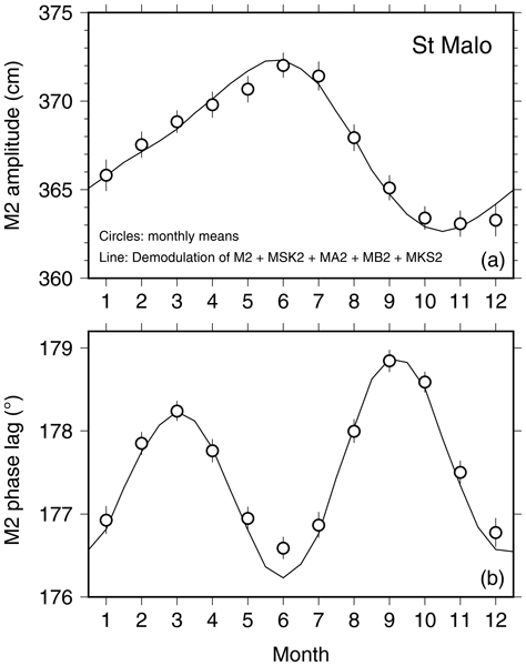
Seasonal variability of the M2 ocean tide can be detected at many ports. The physical mechanisms underlying seasonality, in the broadest terms, are astronomical, frictional–advective interactions, and climate processes. Some of these induce annual modulations, some semiannual, in amplitude, phase, or both. This note reviews how this occurs and gives an example from each broad category. Phase conventions and their relationship with causal mechanisms, as well as nomenclature, are also addressed.
Begoña Pérez Gómez, Ivica Vilibić, Jadranka Šepić, Iva Međugorac, Matjaž Ličer, Laurent Testut, Claire Fraboul, Marta Marcos, Hassen Abdellaoui, Enrique Álvarez Fanjul, Darko Barbalić, Benjamín Casas, Antonio Castaño-Tierno, Srđan Čupić, Aldo Drago, María Angeles Fraile, Daniele A. Galliano, Adam Gauci, Branislav Gloginja, Víctor Martín Guijarro, Maja Jeromel, Marcos Larrad Revuelto, Ayah Lazar, Ibrahim Haktan Keskin, Igor Medvedev, Abdelkader Menassri, Mohamed Aïssa Meslem, Hrvoje Mihanović, Sara Morucci, Dragos Niculescu, José Manuel Quijano de Benito, Josep Pascual, Atanas Palazov, Marco Picone, Fabio Raicich, Mohamed Said, Jordi Salat, Erdinc Sezen, Mehmet Simav, Georgios Sylaios, Elena Tel, Joaquín Tintoré, Klodian Zaimi, and George Zodiatis
Ocean Sci., 18, 997–1053, https://doi.org/10.5194/os-18-997-2022, https://doi.org/10.5194/os-18-997-2022, 2022
Short summary
Short summary
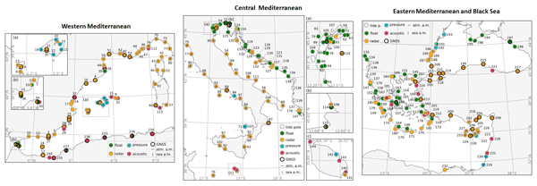
This description and mapping of coastal sea level monitoring networks in the Mediterranean and Black seas reveals the existence of 240 presently operational tide gauges. Information is provided about the type of sensor, time sampling, data availability, and ancillary measurements. An assessment of the fit-for-purpose status of the network is also included, along with recommendations to mitigate existing bottlenecks and improve the network, in a context of sea level rise and increasing extremes.
Martin Horwath, Benjamin D. Gutknecht, Anny Cazenave, Hindumathi Kulaiappan Palanisamy, Florence Marti, Ben Marzeion, Frank Paul, Raymond Le Bris, Anna E. Hogg, Inès Otosaka, Andrew Shepherd, Petra Döll, Denise Cáceres, Hannes Müller Schmied, Johnny A. Johannessen, Jan Even Øie Nilsen, Roshin P. Raj, René Forsberg, Louise Sandberg Sørensen, Valentina R. Barletta, Sebastian B. Simonsen, Per Knudsen, Ole Baltazar Andersen, Heidi Ranndal, Stine K. Rose, Christopher J. Merchant, Claire R. Macintosh, Karina von Schuckmann, Kristin Novotny, Andreas Groh, Marco Restano, and Jérôme Benveniste
Earth Syst. Sci. Data, 14, 411–447, https://doi.org/10.5194/essd-14-411-2022, https://doi.org/10.5194/essd-14-411-2022, 2022
Short summary
Short summary
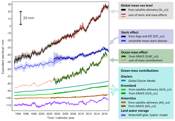
Global mean sea-level change observed from 1993 to 2016 (mean rate of 3.05 mm yr−1) matches the combined effect of changes in water density (thermal expansion) and ocean mass. Ocean-mass change has been assessed through the contributions from glaciers, ice sheets, and land water storage or directly from satellite data since 2003. Our budget assessments of linear trends and monthly anomalies utilise new datasets and uncertainty characterisations developed within ESA's Climate Change Initiative.
Carsten Bjerre Ludwigsen, Ole Baltazar Andersen, and Stine Kildegaard Rose
Ocean Sci., 18, 109–127, https://doi.org/10.5194/os-18-109-2022, https://doi.org/10.5194/os-18-109-2022, 2022
Short summary
Short summary
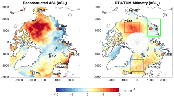
This study uses a novel satellite-independent approach to quantify the components of Arctic sea level change. The 21-year time series allows studying climate-related changes in Arctic sea level. The decomposition shows that fresh water is governing sea level change, while Arctic land ice loss contributes to a small Arctic sea level rise. The reconstruction yields good agreement with sea level observations from altimetry, despite both datasets being challenged by the harsh environment.
David T. Pugh, Edmund Bridge, Robin Edwards, Peter Hogarth, Guy Westbrook, Philip L. Woodworth, and Gerard D. McCarthy
Ocean Sci., 17, 1623–1637, https://doi.org/10.5194/os-17-1623-2021, https://doi.org/10.5194/os-17-1623-2021, 2021
Short summary
Short summary
Observations of sea level, taken manually by reading a tide pole, were carefully taken at a number of locations around Ireland in 1842 as part of the first land survey of Ireland. Our study investigates how useful this type of sea level observation is for understanding mean sea level and tidal change. We find that when carefully adjusted for seasonal, meteorological, and astronomical factors, these data can provide important insights into changing sea levels.
Michael G. Hart-Davis, Gaia Piccioni, Denise Dettmering, Christian Schwatke, Marcello Passaro, and Florian Seitz
Earth Syst. Sci. Data, 13, 3869–3884, https://doi.org/10.5194/essd-13-3869-2021, https://doi.org/10.5194/essd-13-3869-2021, 2021
Short summary
Short summary
Ocean tides are an extremely important process for a variety of oceanographic applications, particularly in understanding coastal sea-level rise. Tidal signals influence satellite altimetry estimations of the sea surface, which has resulted in the development of ocean tide models to account for such signals. The EOT20 ocean tide model has been developed at DGFI-TUM using residual analysis of satellite altimetry, with the focus on improving the estimation of ocean tides in the coastal region.
Denise Dettmering, Felix L. Müller, Julius Oelsmann, Marcello Passaro, Christian Schwatke, Marco Restano, Jérôme Benveniste, and Florian Seitz
Earth Syst. Sci. Data, 13, 3733–3753, https://doi.org/10.5194/essd-13-3733-2021, https://doi.org/10.5194/essd-13-3733-2021, 2021
Short summary
Short summary
In this study, a new gridded altimetry-based regional sea level dataset for the North Sea is presented, named North SEAL. It is based on long-term multi-mission cross-calibrated altimetry data consistently preprocessed with coastal dedicated algorithms. On a 6–8 km wide triangular mesh, North SEAL provides time series of monthly sea level anomalies as well as sea level trends and amplitudes of the mean annual sea level cycle for the period 1995–2019 for various applications.
Philip L. Woodworth, J. A. Mattias Green, Richard D. Ray, and John M. Huthnance
Ocean Sci., 17, 809–818, https://doi.org/10.5194/os-17-809-2021, https://doi.org/10.5194/os-17-809-2021, 2021
Short summary
Short summary
This special issue marks the 100th anniversary of the founding of the Liverpool Tidal Institute (LTI). The preface gives a history of the LTI founding and of its first two directors. It also gives an overview of LTI research on tides. Summaries are given of the 26 papers in the special issue. Their topics could be thought of as providing a continuation of the research first undertaken at the LTI. They provide an interesting snapshot of work on tides now being made by groups around the world.
Cited articles
Akan, Ç., Moghimi, S., Özkan-Haller, H. T., Osborne, J., and Kurapov, A.: On the dynamics of the Mouth of the Columbia River: results from a three-dimensional fully coupled wave-current interaction model, J. Geophys. Res.-Oceans, 122, 5218–5236, https://doi.org/10.1002/2016JC012307, 2017. a
Andersen, O. B., Egbert, G. D., Erofeeva, S. Y., and Ray, R. D.: Mapping nonlinear shallow-water tides: a look at the past and future, Ocean Dynam., 56, 416–429, https://doi.org/10.1007/s10236-006-0060-7, 2006. a
Arbic, B. K.: Atmospheric forcing of the oceanic semidiurnal tide, Geophys. Res. Lett., 32, L02610, https://doi.org/10.1029/2004GL021668, 2005. a
Beemster, J. G. W., Talke, S. A., Van Maren, D. S., Giloy, N., Wünsche, A., Zhang, W., Grasso, F., and Hoitink, A. J. F.: Human footprint on estuarine tidal hydrodynamics, Nat. Geosci., https://doi.org/10.1038/s41561-026-01969-4, 2026. a
Bradshaw, E., Rickards, L., and Aarup, T.: Sea level data archaeology and the Global Sea Level Observing System (GLOSS), GeoResJ, 6, 9–16, https://doi.org/10.1016/j.grj.2015.02.005, 2015. a
Burchard, H., Schuttelaars, H. M., and Ralston, D. K.: Sediment trapping in estuaries, Annu. Rev. Mar. Sci., 10, 371–395, https://doi.org/10.1146/annurev-marine-010816-060535, 2018. a
Codiga, D. L.: Unified tidal analysis and prediction using the U_Tide MATLAB functions, Tech. Rep. URI/GSO Technical Report 2011-01, University of Rhode Island, https://doi.org/10.13140/RG.2.1.3761.2008, 2011. a
De Ruyter, M.: Captain Inglis and his tide machines: the dodging tides of Port Adelaide, from South Australia to the Pacific War at Tarawa, The Mariner's Mirror, 111, 312–325, https://doi.org/10.1080/00253359.2025.2527483, 2025. a
Devlin, A. T., Jay, D. A., Talke, S. A., and Zaron, E.: Can tidal perturbations associated with sea level variations in the western Pacific Ocean be used to understand future effects of tidal evolution?, Ocean Dynam., 64, 1093–1120, 2014. a
Doodson, A. T.: The harmonic development of the tide-generating potential, P. Roy. Soc. A-Math. Phy., 100, 305–329, https://doi.org/10.1098/rspa.1921.0088, 1921. a, b
Doodson, A. T.: Perturbations of harmonic tidal constants, P. Roy. Soc. A-Math. Phy., 106, 513–526, https://doi.org/10.1098/rspa.1924.0085, 1924. a
Doodson, A. T.: The analysis of high and low waters, Int. Hydrogr. Rev., 28, 13–77, 1951. a
El-Sabh, M. I. and Murty, T. S.: Technical note: age of diurnal tide in the World Oceans, Mar. Geod., 13, 159–166, https://doi.org/10.1080/15210608909379616, 1989. a
El-Sabh, M. I., Murty, T. S., and Côté, R.: Variations of the age of tides in the global oceans, Mar. Geod., 11, 153–171, https://doi.org/10.1080/15210608709379557, 1987. a
Enríquez, A. R., Wahl, T., Baranes, H. E., Talke, S. A., Orton, P. M., Booth, J. F., and Haigh, I. D.: Predictable changes in extreme sea levels and coastal flood risk due to long-term tidal cycles, J. Geophys. Res.-Oceans, 127, e2021JC018157, https://doi.org/10.1029/2021JC018157, 2022. a
Familkhalili, R. and Talke, S. A.: The effect of channel deepening on tides and storm surge: a case study of Wilmington, NC, Geophys. Res. Lett., 43, 9138–9147, https://doi.org/10.1002/2016gl069494, 2016. a
Familkhalili, R., Talke, S. A., and Jay, D. A.: Tide-storm surge interactions in highly altered estuaries: how channel deepening increases surge vulnerability, J. Geophys. Res.-Oceans, 125, e2019JC015286, https://doi.org/10.1029/2019JC015286, 2020. a, b
Feng, X., Tsimplis, M. N., and Woodworth, P. L.: Nodal variations and long-term changes in the main tides on the coasts of China, J. Geophys. Res.-Oceans, 120, 1215–1232, https://doi.org/10.1002/2014JC010312, 2015. a
Flick, R. E., Murray, J. F., and Ewing, L. C.: Trends in United States tidal datum statistics and tide range, J. Waterw. Port C., 129, 155–164, https://doi.org/10.1061/(asce)0733-950x(2003)129:4(155), 2003. a
Foreman, M. G. G.: Manual for tidal heights analysis and prediction, Tech. Rep. Pacific Marine Science Report 77-10, Institute of Ocean Sciences, Canadian Government, https://waves-vagues.dfo-mpo.gc.ca/Library/54866.pdf (last access: 26 May 2026), 1977. a
Foreman, M. G. G. and Henry, R. F.: Tidal Analysis Based on High and Low Water Observations, Tech. Rep. Pacific Marine Science Report 79-15, Institute of Ocean Sciences, https://coilink.org/20.500.12592/9qk8kc3 (last access: 26 May 2026), 1979. a
Foreman, M. G. and Neufeld, E. T.: Harmonic tidal analysis of long time series, Int. Hydrogr. Rev., 68, 85–108, https://journals.lib.unb.ca/index.php/ihr/article/view/23289, 1991. a
Gan, M., Pan, H., Chen, Y., and Pan, S.: Application of the Variational Mode Decomposition (VMD) method to river tides, Estuar. Coast. Shelf S., 261, 107570, https://doi.org/10.1016/j.ecss.2021.107570, 2021. a
Garrett, C. J. R. and Munk, W. H.: The age of the tide and the Q of the oceans, Deep Sea Research and Oceanographic Abstracts, 18, 493–503, https://doi.org/10.1016/0011-7471(71)90073-8, 1971. a
George, K. and Simon, B.: The species concordance method of tide prediction in estuaries, Int. Hydrogr. Rev., 61, 61–86, 1984. a
Geyer, W. R. and MacCready, P.: The estuarine circulation, Annu. Rev. Fluid Mech., 46, 175–197, https://doi.org/10.1146/annurev-fluid-010313-141302, 2014. a
Gil, E. and De Toro, C.: New determinations of the ages of tide in the North Atlantic Ocean, Mar. Geod., 28, 231–249, https://doi.org/10.1080/01490410500204579, 2005. a
Godin, G.: The Analysis of Tides, University of Toronto Press, Toronto, 264 pp., ISBN 0-8020-1747-9, 1972. a
Green, J. A. M., Green, C. L., Bigg, G. R., Rippeth, T. P., Scourse, J. D., and Uehara, K.: Tidal mixing and the meridional overturning circulation from the last glacial maximum, Geophys. Res. Lett., 36, https://doi.org/10.1029/2009GL039309, 2009. a
Haigh, I. D., Pickering, M. D., Green, J. A. M., Arbic, B. K., Arns, A., Dangendorf, S., Hill, D. F., Horsburgh, K., Howard, T., Idier, D., Jay, D. A., Jänicke, L., Lee, S. B., Müller, M., Schindelegger, M., Talke, S. A., Wilmes, S., and Woodworth, P. L.: The tides they are a-Changin': a comprehensive review of past and future nonastronomical changes in tides, their driving mechanisms, and future implications, Rev. Geophys., 58, e2018RG000636, https://doi.org/10.1029/2018RG000636, 2020. a, b
Haigh, I. D., Marcos, M., Talke, S. A., Woodworth, P. L., Hunter, J. R., Hague, B. S., Arns, A., Bradshaw, E., Thompson, P., Domingues, C. M., Piecuch, C. G., Santamaria-Aguilar, D., Navas, F. M., Hermans, T. H. J., Tadesse, M., Rashid, M. M., and Wahl, T.: GESLA Version 3: a major update to the global higher-frequency sea-level dataset, Geosci. Data J., 10, 293–314, https://doi.org/10.1002/gdj3.174, 2022. a, b, c, d, e
Hart-Davis, M. G., Dettmering, D., Sulzbach, R., Thomas, M., Schwatke, C., and Seitz, F.: Regional evaluation of minor tidal constituents for improved estimation of ocean tides, Remote Sens.-Basel, 13, 3310, https://doi.org/10.3390/rs13163310, 2021. a
Hart-Davis, M. G., Howard, S. L., Ray, R. D., Andersen, O. B., Padman, L., Nilsen, F., and Dettmering, D.: ArcTiCA: Arctic tidal constituents atlas, Scientific Data, 11, 167, https://doi.org/10.1038/s41597-024-03012-w, 2024. a
Hart-Davis, M., Dettmering, D. and Seitz, F.: TICON-4: TIdal CONstants based on GESLA-4 sea-level records, SEANOE [data set], https://doi.org/10.17882/109129, 2025. a, b, c, d
Hart-Davis, M. G., Scherer, D., Schwatke, C., Sawyer, A. H., Pavelsky, T. M., Ray, R. D., Matte, P., Dettmering, D., and Seitz, F.: Observing the tidal pulse of rivers from wide-swath satellite altimetry, Nature, 652, 371–378, https://doi.org/10.1038/s41586-026-10287-z, 2026a. a
Hart-Davis, M., Sulzbach, R., and Talke, S.: Tidal characteristics from tide gauge data (data), SEANOE [data set], https://doi.org/10.17882/111620, 2026b. a
Hartmann, T. and Wenzel, H.: The harmonic development of the Earth tide generating potential due to the direct effect of the planets, Geophys. Res. Lett., 21, 1991–1993, https://doi.org/10.1029/94GL01684, 1994. a
Hartmann, T. and Wenzel, H.: The HW95 tidal potential catalogue, Geophys. Res. Lett., 22, 3553–3556, https://doi.org/10.1029/95GL03324, 1995. a, b
Hijma, M. P., Engelhart, S. E., Törnqvist, T. E., Horton, B. P., Hu, P., and Hill, D. F.: A protocol for a geological sea-level database, in: Handbook of Sea Level Research, edited by: Shennan, I., Long, A. J., and Horton, B. P., Wiley, https://doi.org/10.1002/9781118452547.ch34, 2015. a
Hoitink, A. F. and Jay, D. A.: Tidal river dynamics: implications for deltas, Rev. Geophys., 54, 240–272, https://doi.org/10.1002/2015RG000507, 2016. a
Horner-Devine, A. R., Jay, D. A., Orton, P. M., and Spahn, E. Y.: A conceptual model of the strongly tidal Columbia River plume, J. Marine Syst., 78, 460–475, https://doi.org/10.1016/j.jmarsys.2008.11.025, 2009. a
Horsburgh, K. J. and Wilson, C.: Tide-surge interaction and its role in the distribution of surge residuals in the North Sea, J. Geophys. Res.-Oceans, 112, https://doi.org/10.1029/2006JC004033, 2007. a, b, c
Hunter, J. R.: On the temperature correction of the Aquatrak acoustic tide gauge, J. Atmos. Ocean. Tech., 20, 1230–1235, https://doi.org/10.1175/1520-0426(2003)020<1230:ottcot>2.0.co;2, 2003. a
Hunter, J. R., Woodworth, P. L., Wahl, T., and Nicholls, R. J.: Using global tide gauge data to validate and improve the representation of extreme sea levels in flood impact studies, Global Planet. Change, 156, 34–45, https://doi.org/10.1016/j.gloplacha.2017.06.007, 2017. a
Huthnance, J. M.: On shelf-sea resonance with application to Brazilian M3 tides, Deep-Sea Res., 27, 347–366, https://doi.org/10.1016/0198-0149(80)90031-X, 1980. a
Idier, D., Dumas, F., and Muller, H.: Tide-surge interaction in the English Channel, Nat. Hazards Earth Syst. Sci., 12, 3709–3718, https://doi.org/10.5194/nhess-12-3709-2012, 2012. a
Jay, D. A.: Green's law revisited: tidal long-wave propagation in channels with strong topography, J. Geophys. Res.-Oceans, 96, 20585–20598, https://doi.org/10.1029/91JC01633, 1991. a, b
Jay, D. A.: Evolution of tidal amplitudes in the eastern Pacific Ocean, Geophys. Res. Lett., 36, https://doi.org/10.1029/2008GL036185, 2009. a
Jay, D. A. and Flinchem, E. P.: Interaction of fluctuating river flow with a barotropic tide: a demonstration of wavelet tidal analysis methods, J. Geophys. Res.-Oceans, 102, 5705–5720, https://doi.org/10.1029/96JC00496, 1997. a
Kästner, K., Hoitink, A. J. F., Torfs, P. J. J. F., Deleersnijder, E., and Ningsih, N. S.: Propagation of tides along a river with a sloping bed, J. Fluid Mech., 872, 39–73, https://doi.org/10.1017/jfm.2019.331, 2019. a
Kvas, A., Behzadpour, S., Ellmer, M., Klinger, B., Strasser, S., Zehentner, N., and Mayer-Gürr, T.: ITSG-Grace2018: overview and evaluation of a new GRACE-only gravity field time series, J. Geophys. Res.-Sol. Ea., 124, 9332–9344, https://doi.org/10.1029/2019JB017415, 2019. a
Larson, K. M., Ray, R. D., Nievinski, F. G., and Freymueller, J. T.: The accidental tide gauge: a GPS reflection case study from Kachemak Bay, Alaska, IEEE Geosci. Remote S., 10, 1200–1204, https://doi.org/10.1109/LGRS.2012.2236075, 2013. a
Latapy, A., Ferret, Y., Testut, L., Talke, S., Aarup, T., Pons, F., Woodworth, P. L., and Wöppelmann, G.: Data rescue process in the context of sea level reconstructions: an overview of the methodology, lessons learned, up-to-date best practices and recommendations, Geosci. Data J., 10, 396–425, https://doi.org/10.1002/gdj3.179, 2023. a
Leffler, K. E. and Jay, D. A.: Enhancing tidal harmonic analysis: Robust (hybrid ) solutions, Cont. Shelf Res., 29, 78–88, https://doi.org/10.1016/j.csr.2008.04.011, 2009. a
Lobo, M., Jay, D. A., Innocenti, S., Talke, S. A., Dykstra, S. L., and Matte, P.: Implementing superresolution of nonstationary tides with wavelets: an introduction to CWT_Multi, J. Atmos. Ocean. Tech., 41, 969–989, https://doi.org/10.1175/JTECH-D-23-0144.1, 2024. a, b, c
Lubbock, J. W.: On the tides in the port of London, Philosophical Transactions of the Royal Society of London, 121, 379–415, https://doi.org/10.1098/rstl.1831.0022, 1831. a
Lyard, F. H., Allain, D. J., Cancet, M., Carrère, L., and Picot, N.: FES2014 global ocean tide atlas: design and performance, Ocean Sci., 17, 615–649, https://doi.org/10.5194/os-17-615-2021, 2021. a, b, c
Marcos, M., Calafat, F. M., Berihuete, Á., and Dangendorf, S.: Long-term variations in global sea level extremes, J. Geophys. Res.-Oceans, 120, 8115–8134, https://doi.org/10.1002/2015JC011173, 2015. a
Matte, P., Jay, D. A., and Zaron, E. D.: Adaptation of classical tidal harmonic analysis to nonstationary tides, with application to river tides, J. Atmos. Ocean. Tech., 30, 569–589, https://doi.org/10.1175/JTECH-D-12-00016.1, 2013. a, b, c
Menéndez, M. and Woodworth, P. L.: Changes in extreme high water levels based on a quasi-global tide-gauge data set, J. Geophys. Res.-Oceans, 115, https://doi.org/10.1029/2009JC005997, 2010. a
Monahan, T., Tang, T., Roberts, S., and Adcock, T. A. A.: RTide: automating the tidal response method, Journal of Geophysical Research: Machine Learning and Computation, 2, https://doi.org/10.1029/2024jh000525, 2025. a, b, c
Munk, W. H.: Abyssal recipes, Deep Sea Research and Oceanographic Abstracts, 13, 707–730, https://doi.org/10.1016/0011-7471(66)90602-4, 1966. a
Munk, W. H. and Cartwright, D. E.: Tidal spectroscopy and prediction, Philosophical Transactions of the Royal Society of London. Series A, 259, 533–581, https://doi.org/10.1098/rsta.1966.0013, 1966. a, b
Mydlarz, C., Sai Venkat Challagonda, P., Steers, B., Rucker, J., Brain, T., Branco, B., Burnett, H. E., Kaur, A., Fischman, R., Graziano, K., Krueger, K., Hénaff, E., Ignace, V., Jozwiak, E., Palchuri, J., Pierone, P., Rothman, P., Toledo-Crow, R., and Silverman, A. I.: FloodNet: low-cost ultrasonic sensors for real-time measurement of hyperlocal, street-level floods in New York City, Water Resour. Res., 60, e2023WR036806, https://doi.org/10.1029/2023WR036806, 2024. a
Newey, W. K. and West, K. D.: A simple, positive semi-definite, heteroskedasticity and autocorrelation consistent covariance matrix, Econometrica, 55, 703, https://doi.org/10.2307/1913610, 1987. a
Pan, H., Lv, X., Wang, Y., Matte, P., Chen, H., and Jin, G.: Exploration of tidal-fluvial interaction in the Columbia River estuary using S_TIDE, J. Geophys. Res.-Oceans, 123, 6598–6619, https://doi.org/10.1029/2018JC014146, 2018. a
Pan, H., Xu, T., and Wei, Z.: A modified tidal harmonic analysis model for short-term water level observations, Ocean Model., 186, 102251, https://doi.org/10.1016/j.ocemod.2023.102251, 2023. a
Pan, H., Wang, D., Li, B., Xu, T., and Wei, Z.: Timing errors in global sea level observations, Ocean Dynam., 75, 5, https://doi.org/10.1007/s10236-024-01652-5, 2025. a
Parker, B. B.: Tidal Analysis and Prediction, Tech. Rep. Special Publication NOS CO-OPS 3, NOAA, https://doi.org/10.25607/OBP-191, 2007. a, b, c, d
Pawlowicz, R., Beardsley, B., and Lentz, S.: Classical tidal harmonic analysis including error estimates in MATLAB using T_TIDE, Comput. Geosci., 28, 929–937, https://doi.org/10.1016/S0098-3004(02)00013-4, 2002. a
Pingree, R. D., Griffiths, D. K., and Maddock, L.: Quarter diurnal shelf resonances and tidal bed stress in the English Channel, Cont. Shelf Res., 3, 267–289, https://doi.org/10.1016/0278-4343(84)90012-8, 1984. a
Ponte, R. M. and Schindelegger, M.: Seasonal cycle in sea level across the coastal zone, Earth and Space Science, 11, e2024EA003978, https://doi.org/10.1029/2024EA003978, 2024. a
Pouvreau, N.: Trois cents ans de mesures marégraphiques en France: outils, méthodes et tendances des composantes du niveau de la mer au port de Brest, PhD thesis, Université de La Rochelle, La Rochelle, France, https://theses.hal.science/tel-00353660v1 (last access: 26 May 2026), 2008. a
Pugh, D. and Woodworth, P. L.: Sea-Level Science: Understanding Tides, Surges, Tsunamis and Mean Sea-Level Changes, Cambridge University Press, https://doi.org/10.1017/CBO9781139235778, 2014. a, b, c, d
Ray, R. D.: Secular changes in the solar semidiurnal tide of the western North Atlantic Ocean, Geophys. Res. Lett., 36, L19601, https://doi.org/10.1029/2009GL040217, 2009. a
Ray, R. D.: Precise comparisons of bottom-pressure and altimetric ocean tides, J. Geophys. Res.-Oceans, 118, 4570–4584, https://doi.org/10.1002/jgrc.20336, 2013. a
Ray, R. D.: First global observations of third-degree ocean tides, Science Advances, 6, eabd4744, https://doi.org/10.1126/sciadv.abd4744, 2020. a
Ray, R. D.: Technical note: On seasonal variability of the M2 tide, Ocean Sci., 18, 1073–1079, https://doi.org/10.5194/os-18-1073-2022, 2022. a
Ray, R. D.: Documentation for Goddard Ocean Tide Solution GOT5: Global Tides from Multi-mission Satellite Altimetry, NASA Tech. Memo. 20250002085, Goddard Space Flight Center, Greenbelt MD, https://ntrs.nasa.gov/api/citations/20250002085/downloads/GOT5-TechMemo.pdf (last access: 6 May 2026), 2025. a
Ray, R. D. and Schindelegger, M.: Trends in the M2 ocean tide observed by satellite altimetry in the presence of systematic errors, J. Geodesy, 99, https://doi.org/10.1007/s00190-025-01935-9, 2025. a
Ray, R. D. and Talke, S. A.: Nineteenth century tides in the Gulf of Maine and implications for secular trends, J. Geophys. Res.-Oceans, 124, 7046–7067, https://doi.org/10.1029/2019jc015277, 2019. a
Ray, R. D., Loomis, B. D., and Zlotnicki, V.: The mean seasonal cycle in relative sea level from satellite altimetry and gravimetry, J. Geodesy, 95, 80, https://doi.org/10.1007/s00190-021-01529-1, 2021. a
Robins, P. E., Neill, S. P., Lewis, M. J., and Ward, S. L.: Characterising the spatial and temporal variability of the tidal-stream energy resource over the northwest European shelf seas, Appl. Energ., 147, 510–522, https://doi.org/10.1016/j.apenergy.2015.03.045, 2015. a
Sammari, C., Koutitonsky, V. G., and Moussa, M.: Sea level variability and tidal resonance in the Gulf of Gabes, Tunisia, Cont. Shelf Res., 26, 338–350, https://doi.org/10.1016/j.csr.2005.11.006, 2006. a
Shalowitz, A. L.: Shore and Sea Boundaries: Interpretation and use of Coast and Geodetic Survey Data, Vol. 2, US Department of Commerce, American Government, https://nauticalcharts.noaa.gov/about/docs/ (last access: 26 May 2026), 1964. a
Simpson, J. H. and Hunter, J. R.: Fronts in the Irish Sea, Nature, 250, 404–406, https://doi.org/10.1038/250404a0, 1974. a
Simpson, J. H. and Sharples, J.: Introduction to the physical and biological oceanography of shelf seas, Cambridge University Press, https://doi.org/10.1017/CBO9781139034098, 2012. a
Smith, W. N., Thorpe, S. A., and Graham, A.: Surface effects of bottom-generated turbulence in a shallow tidal sea, Nature, 400, 251–254, https://doi.org/10.1038/22295, 1999. a
Stumpf, R. P. and Haines, J. W.: Variations in tidal level in the Gulf of Mexico and implications for tidal wetlands, Estuar. Coast. Shelf S., 46, 165–173, https://doi.org/10.1006/ecss.1997.0276, 1998. a
Su, Y. and Jiang, X.: Prediction of tide level based on variable weight combination of LightGBM and CNN-BiGRU model, Sci. Rep.-UK, 13, 9, https://doi.org/10.1038/s41598-022-26213-y, 2023. a
Sulzbach, R., Wziontek, H., Hart-Davis, M., Dobslaw, H., Scherneck, H.-G., Van Camp, M., Omang, O. C. D., Antokoletz, E. D., Mazurova, E., Thomas, M., and Seitz, F.: Modeling gravimetric signatures of third-degree ocean tides and their detection in superconducting gravimeter records, J. Geodesy, 96, https://doi.org/10.1007/s00190-022-01609-w, 2022. a
Tabibi, S. M., Geremia-Nievinski, F., Francis, O., and Scherneck, H.-G.: Tidal analysis of GNSS reflectometry applied for coastal sea level sensing in Antarctica and Greenland, Remote Sens. Environ., 248, 111959, https://doi.org/10.1016/j.rse.2020.111959, 2020. a
Talke, S. A. and Jay, D. A.: Nineteenth century North American and Pacific tides: lost or just forgotten?, J. Coast. Res., 29, 118–127, https://doi.org/10.2112/JCOASTRES-D-12-00181.1, 2013. a
Talke, S. A. and Jay, D. A.: Changing tides: the role of natural and anthropogenic factors, Annu. Rev. Mar. Sci., 12, 121–151, https://doi.org/10.1146/annurev-marine-010419-010727, 2020. a, b
Talke, S. A., de Swart, H. E., and De Jonge, V. N.: An idealized model and systematic process study of oxygen depletion in highly turbid estuaries, Estuar. Coast., 32, 602–620, https://doi.org/10.1007/s12237-009-9171-y, 2009. a
Talke, S. A., Horner-Devine, A. R., Chickadel, C. C., and Jessup, A. T.: Turbulent kinetic energy and coherent structures in a tidal river, J. Geophys. Res.-Oceans, 118, 6965–6981, https://doi.org/10.1002/2012JC008103, 2013. a, b, c
Thomas, H., Bozec, Y., Elkalay, K., and van Baar, H. J. W.: Enhanced open ocean storage of CO2 from shelf sea pumping, Science, 304, 1005–1008, https://doi.org/10.1126/science.1095491, 2004. a
Thompson, P. R., Widlansky, M. J., Hamlington, B. D., Merrifield, M. A., Marra, J. J., Mitchum, G. T., and Sweet, W.: Rapid increases and extreme months in projections of United States high-tide flooding, Nat. Clim. Change, 11, 584–590, https://doi.org/10.1038/s41558-021-01077-8, 2021. a
Thompson, P. R., Genz, A. S., Widlansky, M. J., Mitchum, G. T., Bradshaw, E., Devlin, A. T., Gómez, B. P., Haigh, I. D., Marcos, M., Matthews, A., and Merrifield, M. A.: Reply to “timing errors in global sea level observations” (Pan et al., 2025), Ocean Dynam., 75, 18, https://doi.org/10.1007/s10236-025-01662-x, 2025. a
Webb, D. J.: On the age of the semi-diurnal tide, Deep-Sea Research and Oceanographic Abstracts, 20, 847–852, https://doi.org/10.1016/0011-7471(73)90006-5, 1973. a, b
Whewell, W.: Essay towards a first approximation to a map of cotidal Lines, Philosophical Transactions of the Royal Society of London, 123, 147–236, https://doi.org/10.1098/rstl.1833.0013, 1833. a
Woodworth, P. L.: A survey of recent changes in the main components of the ocean tide, Cont. Shelf Res., 30, 1680–1691, https://doi.org/10.1016/j.csr.2010.07.002, 2010. a, b
Woodworth, P. L.: The global distribution of the M1 ocean tide, Ocean Sci., 15, 431–442, https://doi.org/10.5194/os-15-431-2019, 2019. a
Woodworth, P. L.: Tidal science before and after Newton, in: A Journey Through Tides, edited by: Green, M. and Duarte, J., Elsevier, https://doi.org/10.1016/B978-0-323-90851-1.00002-9, 3–36, 2023. a
Woodworth, P. L. and Rowe, G. H.: The tidal measurements of James Cook during the voyage of the Endeavour, Hist. Geo Space. Sci., 9, 85–103, https://doi.org/10.5194/hgss-9-85-2018, 2018. a, b
Woodworth, P. L., Hunter, J. R., Marcos, M., Caldwell, P., Menéndez, M., and Haigh, I. D.: Towards a global higher-frequency sea level dataset, Geosci. Data J., 3, 50–59, https://doi.org/10.1002/gdj3.42, 2017. a, b
Wunsch, C. and Ferrari, R.: Vertical mixing, energy, and the general circulation of the oceans, Annu. Rev. Fluid Mech., 36, 281–314, https://doi.org/10.1146/annurev.fluid.36.050802.122121, 2004. a
Zappa, C. J., McGillis, W. R., Raymond, P. A., Edson, J. B., Hintsa, E. J., Zemmelink, H. J., Dacey, J. W., and Ho, D. T.: Environmental turbulent mixing controls on air-water gas exchange in marine and aquatic systems, Geophys. Res. Lett., 34, https://doi.org/10.1029/2006GL028790, 2007. a
Zaron, E. D. and Jay, D. A.: An analysis of secular change in tides at open-ocean sites in the Pacific, J. Phys. Oceanogr., 44, 1704–1726, https://doi.org/10.1175/JPO-D-13-0266.1, 2014. a
Editorial statement
Tide gauges have been critical sources for sea level research, enabling the development of tidal theory and an understanding of local variations that occur across the global oceans. Tides play important roles in a variety of oceanographic and geodetic applications; characterizing their spatial variability is valuable for applications ranging from fishing to flood risk management. Coastal characteristics of ocean tides are presented based on 3,591 high-frequency tide gauge observations. The analysis shows that 125 out of 237 long-time series show statistically significant trends in one or more tide constituents. Particularly the novel results on tidal high-water durations and tidal trends are of interest.
The paper provides a global summary of a number of tidal characteristic quantities that will be useful for tide experts but also for the greater oceanographic community, in particular sea level researchers, providing insights crucial for a wide range of biogeochemical processes. It also presents insights that can be useful for local communities. This paper, along with its accompanying data, could become an important reference in the field.
Tide gauges have been critical sources for sea level research, enabling the development of tidal...
Short summary
Ocean tides are a critical component of the global climate system, influencing a wide range of geophysical processes. Tide gauges have been a valuable source for developing the theory of ocean tides and for understanding their variability. We provide updated and new insights on tidal properties using the Global Extreme Sea Level Analysis tide gauge dataset, intended to be useful to a range of applications, from navigation and fishing communities to ocean scientists and tidal experts.
Ocean tides are a critical component of the global climate system, influencing a wide range of...